村山古道(田子の浦海岸から富士山頂へ)
#01
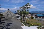
![Check the location where this photo was taken on the web map.[ Lat.: 35.139514, Lon. : 138.702167, Alt. : 30m ]](https://y2works.net/trip/wp-content/plugins/mylightbox2/icons/map_globe_icon_gry_32.png)
富士塚
DateTime: [Oct 08 2012 13:07:17 (Asia/Tokyo)]
Exposures: [F Number: 7.1, Exposure Time: 1/400s, ISO: 100, Exposure Bias: -0.66Ev]
Equipments: [Focal Length: 6.3mm, Maker: Panasonic, Model: DMC-LX2]
Location: [Lat: 35° 8' 22.25" N ( 35.139514° ) , Lon: 138° 42' 7.80" E (138.702167° ) , Altitude: 29.8m ]
#02
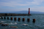
![Check the location where this photo was taken on the web map.[ Lat.: 35.136615, Lon. : 138.699013, Alt. : 4m ]](https://y2works.net/trip/wp-content/plugins/mylightbox2/icons/map_globe_icon_gry_32.png)
田子の浦海岸
DateTime: [Oct 08 2012 13:26:33 (Asia/Tokyo)]
Exposures: [F Number: 7.1, Exposure Time: 1/500s, ISO: 100, Exposure Bias: -0.66Ev]
Equipments: [Focal Length: 10.8mm, Maker: Panasonic, Model: DMC-LX2]
Location: [Lat: 35° 8' 11.81" N ( 35.136615° ) , Lon: 138° 41' 56.45" E (138.699013° ) , Altitude: 3.5m ]
#03
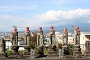
![Check the location where this photo was taken on the web map.[ Lat.: 35.142555, Lon. : 138.703868, Alt. : 10m ]](https://y2works.net/trip/wp-content/plugins/mylightbox2/icons/map_globe_icon_gry_32.png)
六地蔵(閻魔堂)
DateTime: [Oct 08 2012 13:45:17 (Asia/Tokyo)]
Exposures: [F Number: 11.0, Exposure Time: 1/200s, ISO: 100, Exposure Bias: 0.00Ev]
Equipments: [Focal Length: 29.0mm, Maker: Canon, Model: Canon EOS Kiss Digital N]
Location: [Lat: 35° 8' 33.20" N ( 35.142555° ) , Lon: 138° 42' 13.92" E (138.703868° ) , Altitude: 10.1m ]
#04
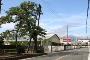
![Check the location where this photo was taken on the web map.[ Lat.: 35.154472, Lon. : 138.697928, Alt. : 5m ]](https://y2works.net/trip/wp-content/plugins/mylightbox2/icons/map_globe_icon_gry_32.png)
名勝左富士
DateTime: [Oct 08 2012 14:49:32 (Asia/Tokyo)]
Exposures: [F Number: 9.0, Exposure Time: 1/200s, ISO: 100, Exposure Bias: 0.00Ev]
Equipments: [Focal Length: 18.0mm, Maker: Canon, Model: Canon EOS Kiss Digital N]
Location: [Lat: 35° 9' 16.10" N ( 35.154472° ) , Lon: 138° 41' 52.54" E (138.697928° ) , Altitude: 5.2m ]
#05
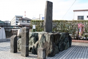
![Check the location where this photo was taken on the web map.[ Lat.: 35.158697, Lon. : 138.696368, Alt. : 4m ]](https://y2works.net/trip/wp-content/plugins/mylightbox2/icons/map_globe_icon_gry_32.png)
平家越え
DateTime: [Oct 08 2012 14:56:40 (Asia/Tokyo)]
Exposures: [F Number: 7.1, Exposure Time: 1/160s, ISO: 100, Exposure Bias: 0.00Ev]
Equipments: [Focal Length: 21.0mm, Maker: Canon, Model: Canon EOS Kiss Digital N]
Location: [Lat: 35° 9' 31.31" N ( 35.158697° ) , Lon: 138° 41' 46.93" E (138.696368° ) , Altitude: 4.5m ]
#06
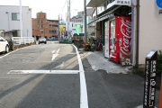
![Check the location where this photo was taken on the web map.[ Lat.: 35.161859, Lon. : 138.679070, Alt. : 7m ]](https://y2works.net/trip/wp-content/plugins/mylightbox2/icons/map_globe_icon_gry_32.png)
西木戸跡
DateTime: [Oct 08 2012 15:34:48 (Asia/Tokyo)]
Exposures: [F Number: 7.1, Exposure Time: 1/125s, ISO: 100, Exposure Bias: 0.00Ev]
Equipments: [Focal Length: 18.0mm, Maker: Canon, Model: Canon EOS Kiss Digital N]
Location: [Lat: 35° 9' 42.69" N ( 35.161859° ) , Lon: 138° 40' 44.65" E (138.679070° ) , Altitude: 6.9m ]
#07
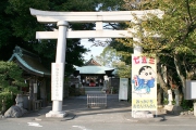
![Check the location where this photo was taken on the web map.[ Lat.: 35.166645, Lon. : 138.675755, Alt. : 7m ]](https://y2works.net/trip/wp-content/plugins/mylightbox2/icons/map_globe_icon_gry_32.png)
富知六所浅間神社
DateTime: [Oct 08 2012 15:50:10 (Asia/Tokyo)]
Exposures: [F Number: 7.1, Exposure Time: 1/125s, ISO: 100, Exposure Bias: 0.00Ev]
Equipments: [Focal Length: 18.0mm, Maker: Canon, Model: Canon EOS Kiss Digital N]
Location: [Lat: 35° 9' 59.92" N ( 35.166645° ) , Lon: 138° 40' 32.72" E (138.675755° ) , Altitude: 7.4m ]
#08
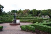
![Check the location where this photo was taken on the web map.[ Lat.: 35.186217, Lon. : 138.678250, Alt. : 100m ]](https://y2works.net/trip/wp-content/plugins/mylightbox2/icons/map_globe_icon_gry_32.png)
広見公園
DateTime: [Oct 08 2012 16:48:03 (Asia/Tokyo)]
Exposures: [F Number: 5.6, Exposure Time: 1/40s, ISO: 100, Exposure Bias: 0.00Ev]
Equipments: [Focal Length: 18.0mm, Maker: Canon, Model: Canon EOS Kiss Digital N]
Location: [Lat: 35° 11' 10.38" N ( 35.186217° ) , Lon: 138° 40' 41.70" E (138.678250° ) , Altitude: 99.6m ]
#09
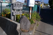
![Check the location where this photo was taken on the web map.[ Lat.: 35.197809, Lon. : 138.676402, Alt. : 151m ]](https://y2works.net/trip/wp-content/plugins/mylightbox2/icons/map_globe_icon_gry_32.png)
道しるべ
DateTime: [Oct 13 2012 08:53:12 (Asia/Tokyo)]
Exposures: [F Number: 5.6, Exposure Time: 1/320s, ISO: 100, Exposure Bias: -0.66Ev]
Equipments: [Focal Length: 6.3mm, Maker: Panasonic, Model: DMC-LX2]
Location: [Lat: 35° 11' 52.11" N ( 35.197809° ) , Lon: 138° 40' 35.05" E (138.676402° ) , Altitude: 150.6m ]
#10
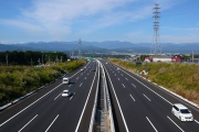
![Check the location where this photo was taken on the web map.[ Lat.: 35.202265, Lon. : 138.674647, Alt. : 170m ]](https://y2works.net/trip/wp-content/plugins/mylightbox2/icons/map_globe_icon_gry_32.png)
第二東名高速
DateTime: [Oct 13 2012 09:05:48 (Asia/Tokyo)]
Exposures: [F Number: 6.3, Exposure Time: 1/400s, ISO: 100, Exposure Bias: -0.66Ev]
Equipments: [Focal Length: 6.3mm, Maker: Panasonic, Model: DMC-LX2]
Location: [Lat: 35° 12' 8.15" N ( 35.202265° ) , Lon: 138° 40' 28.73" E (138.674647° ) , Altitude: 169.6m ]
#11

![Check the location where this photo was taken on the web map.[ Lat.: 35.210628, Lon. : 138.670498, Alt. : 187m ]](https://y2works.net/trip/wp-content/plugins/mylightbox2/icons/map_globe_icon_gry_32.png)
お茶畑
DateTime: [Oct 13 2012 09:21:41 (Asia/Tokyo)]
Exposures: [F Number: 5.6, Exposure Time: 1/500s, ISO: 100, Exposure Bias: -0.66Ev]
Equipments: [Focal Length: 11.6mm, Maker: Panasonic, Model: DMC-LX2]
Location: [Lat: 35° 12' 38.26" N ( 35.210628° ) , Lon: 138° 40' 13.79" E (138.670498° ) , Altitude: 186.6m ]
#12
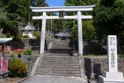
![Check the location where this photo was taken on the web map.[ Lat.: 35.260755, Lon. : 138.666005, Alt. : 487m ]](https://y2works.net/trip/wp-content/plugins/mylightbox2/icons/map_globe_icon_gry_32.png)
村山浅間神社
DateTime: [Oct 13 2012 11:15:43 (Asia/Tokyo)]
Exposures: [F Number: 5.6, Exposure Time: 1/250s, ISO: 100, Exposure Bias: -0.66Ev]
Equipments: [Focal Length: 6.3mm, Maker: Panasonic, Model: DMC-LX2]
Location: [Lat: 35° 15' 38.72" N ( 35.260755° ) , Lon: 138° 39' 57.62" E (138.666005° ) , Altitude: 486.6m ]
#13

![Check the location where this photo was taken on the web map.[ Lat.: 35.276811, Lon. : 138.698413, Alt. : 831m ]](https://y2works.net/trip/wp-content/plugins/mylightbox2/icons/map_globe_icon_gry_32.png)
札打ち場
DateTime: [Oct 13 2012 13:30:38 (Asia/Tokyo)]
Exposures: [F Number: 2.8, Exposure Time: 1/30s, ISO: 125, Exposure Bias: 0.00Ev]
Equipments: [Focal Length: 6.3mm, Maker: Panasonic, Model: DMC-LX2]
Location: [Lat: 35° 16' 36.52" N ( 35.276811° ) , Lon: 138° 41' 54.29" E (138.698413° ) , Altitude: 831.2m ]
#14
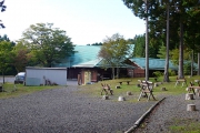
![Check the location where this photo was taken on the web map.[ Lat.: 35.285664, Lon. : 138.717064, Alt. : 1075m ]](https://y2works.net/trip/wp-content/plugins/mylightbox2/icons/map_globe_icon_gry_32.png)
富士山麓山の村
DateTime: [Oct 13 2012 14:30:58 (Asia/Tokyo)]
Exposures: [F Number: 4.0, Exposure Time: 1/160s, ISO: 100, Exposure Bias: 0.00Ev]
Equipments: [Focal Length: 7.5mm, Maker: Panasonic, Model: DMC-LX2]
Location: [Lat: 35° 17' 8.39" N ( 35.285664° ) , Lon: 138° 43' 1.43" E (138.717064° ) , Altitude: 1074.9m ]
#15
![Check the location where this photo was taken on the web map.[ Lat.: 35.300039, Lon. : 138.726416, Alt. : 1253m ]](https://y2works.net/trip/wp-content/plugins/mylightbox2/icons/map_globe_icon_gry_32.png)
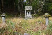
中宮八幡堂跡
DateTime: [Oct 13 2012 15:15:44 (Asia/Tokyo)]
Exposures: [F Number: 2.8, Exposure Time: 1/60s, ISO: 100, Exposure Bias: 0.00Ev]
Equipments: [Focal Length: 6.3mm, Maker: Panasonic, Model: DMC-LX2]
Location: [Lat: 35° 18' 0.14" N ( 35.300039° ) , Lon: 138° 43' 35.10" E (138.726416° ) , Altitude: 1252.7m ]
#16
![Check the location where this photo was taken on the web map.[ Lat.: 35.339180, Lon. : 138.738000, Alt. : 2488m ]](https://y2works.net/trip/wp-content/plugins/mylightbox2/icons/map_globe_icon_gry_32.png)
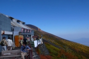
富士宮口新6合目
DateTime: [Oct 21 2012 13:04:19 (Asia/Tokyo)]
Exposures: [F Number: 6.3, Exposure Time: 1/400s, ISO: 100, Exposure Bias: -0.66Ev]
Equipments: [Focal Length: 6.3mm, Maker: Panasonic, Model: DMC-LX2]
Location: [Lat: 35° 20' 21.05" N ( 35.339180° ) , Lon: 138° 44' 16.80" E (138.738000° ) , Altitude: 2487.6m ]
Track #1. 田子の浦海岸 → 広見公園(富士市) 10/08 2012
https://y2works.net/trip/wp-content/uploads/GPS/Y2012/Murayama01.gpx
Track #2. 広見公園 → 富士山スカイライン 10/13 2012
https://y2works.net/trip/wp-content/uploads/GPS/Y2012/Murayama02.gpx
Track #3. 富士山スカイライン → 富士宮口新6合目 10/21 2012
https://y2works.net/trip/wp-content/uploads/GPS/Y2012/Murayama03.gpx
Track #4. 富士宮口新6合目 → 富士山頂(剣が峰) 10/09 2011
https://y2works.net/trip/wp-content/uploads/GPS/Y2012/Murayama04.gpx
シングルトラック(上記の4つのGPXトラックデータを併合して一つのトラックに纏めたもの)
https://y2works.net/trip/wp-content/uploads/GPS/Y2012/MurayamaTrailMerged.gpx
※ GPXトラックデータの中身は、道草や道迷い、休憩中などの余分なデータをカットしてあるので、データは飛び飛びの繋ぎ合わせになっている.
田子の浦海岸から剣が峰山頂まで一気に目指す場合は、
1日目: 田子の浦海岸〜村山浅間神社
2日目: 村山浅間神社〜富士宮口新6合目
3日目: 富士宮口新6合目〜富士山頂
で区切るのが無難なところだろう.


