暇つぶしに大野山へ
#01
![Check the location where this photo was taken on the web map.[ Lat.: 35.366277, Lon. : 139.038172, Alt. : 182m ]](https://y2works.net/trip/wp-content/plugins/mylightbox2/icons/map_globe_icon_gry_32.png)
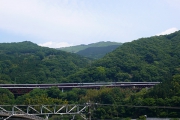
とりあえず大野山へ行ってみることにした
DateTime: [May 26 2012 10:21:39 (Asia/Tokyo)]
Exposures: [F Number: 5.6, Exposure Time: 1/400s, ISO: 100, Exposure Bias: -0.66Ev]
Equipments: [Focal Length: 10.8mm, Maker: Panasonic, Model: DMC-LX2]
Location: [Lat: 35° 21' 58.60" N ( 35.366277° ) , Lon: 139° 2' 17.42" E (139.038172° ) , Altitude: 182.2m ]
#02
![Check the location where this photo was taken on the web map.[ Lat.: 35.368205, Lon. : 139.038560, Alt. : 199m ]](https://y2works.net/trip/wp-content/plugins/mylightbox2/icons/map_globe_icon_gry_32.png)
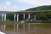
ちょうど田植えの真っ最中
DateTime: [May 26 2012 10:27:17 (Asia/Tokyo)]
Exposures: [F Number: 5.6, Exposure Time: 1/320s, ISO: 100, Exposure Bias: -0.66Ev]
Equipments: [Focal Length: 6.3mm, Maker: Panasonic, Model: DMC-LX2]
Location: [Lat: 35° 22' 5.54" N ( 35.368205° ) , Lon: 139° 2' 18.82" E (139.038560° ) , Altitude: 198.9m ]
#03
![Check the location where this photo was taken on the web map.[ Lat.: 35.373387, Lon. : 139.043983, Alt. : 335m ]](https://y2works.net/trip/wp-content/plugins/mylightbox2/icons/map_globe_icon_gry_32.png)
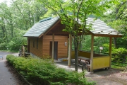
立派なバイオ公衆トイレ
DateTime: [May 26 2012 11:05:29 (Asia/Tokyo)]
Exposures: [F Number: 4.0, Exposure Time: 1/100s, ISO: 100, Exposure Bias: -0.66Ev]
Equipments: [Focal Length: 6.3mm, Maker: Panasonic, Model: DMC-LX2]
Location: [Lat: 35° 22' 24.19" N ( 35.373387° ) , Lon: 139° 2' 38.34" E (139.043983° ) , Altitude: 334.8m ]
#04
![Check the location where this photo was taken on the web map.[ Lat.: 35.376550, Lon. : 139.046623, Alt. : 452m ]](https://y2works.net/trip/wp-content/plugins/mylightbox2/icons/map_globe_icon_gry_32.png)
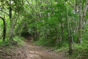
初心者向けの整備されたハイキングコース
DateTime: [May 26 2012 11:14:29 (Asia/Tokyo)]
Exposures: [F Number: 2.8, Exposure Time: 1/50s, ISO: 100, Exposure Bias: -0.66Ev]
Equipments: [Focal Length: 6.3mm, Maker: Panasonic, Model: DMC-LX2]
Location: [Lat: 35° 22' 35.58" N ( 35.376550° ) , Lon: 139° 2' 47.84" E (139.046623° ) , Altitude: 452.3m ]
#05
![Check the location where this photo was taken on the web map.[ Lat.: 35.380810, Lon. : 139.047542, Alt. : 668m ]](https://y2works.net/trip/wp-content/plugins/mylightbox2/icons/map_globe_icon_gry_32.png)
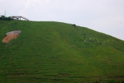
今日は牛さん達も放牧されていた
DateTime: [May 26 2012 11:36:44 (Asia/Tokyo)]
Exposures: [F Number: 5.6, Exposure Time: 1/320s, ISO: 100, Exposure Bias: -0.66Ev]
Equipments: [Focal Length: 25.2mm, Maker: Panasonic, Model: DMC-LX2]
Location: [Lat: 35° 22' 50.92" N ( 35.380810° ) , Lon: 139° 2' 51.15" E (139.047542° ) , Altitude: 667.8m ]
#06
![Check the location where this photo was taken on the web map.[ Lat.: 35.384968, Lon. : 139.046733, Alt. : 728m ]](https://y2works.net/trip/wp-content/plugins/mylightbox2/icons/map_globe_icon_gry_32.png)
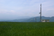
富士山は雲の中
DateTime: [May 26 2012 11:48:52 (Asia/Tokyo)]
Exposures: [F Number: 8.0, Exposure Time: 1/400s, ISO: 100, Exposure Bias: -0.66Ev]
Equipments: [Focal Length: 6.3mm, Maker: Panasonic, Model: DMC-LX2]
Location: [Lat: 35° 23' 5.89" N ( 35.384968° ) , Lon: 139° 2' 48.24" E (139.046733° ) , Altitude: 727.6m ]
#07
![Check the location where this photo was taken on the web map.[ Lat.: 35.386583, Lon. : 139.048807, Alt. : 756m ]](https://y2works.net/trip/wp-content/plugins/mylightbox2/icons/map_globe_icon_gry_32.png)
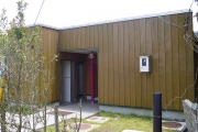
頂上には真新しいトイレが建てられていた
DateTime: [May 26 2012 11:52:37 (Asia/Tokyo)]
Exposures: [F Number: 4.5, Exposure Time: 1/200s, ISO: 100, Exposure Bias: -0.66Ev]
Equipments: [Focal Length: 6.3mm, Maker: Panasonic, Model: DMC-LX2]
Location: [Lat: 35° 23' 11.70" N ( 35.386583° ) , Lon: 139° 2' 55.70" E (139.048807° ) , Altitude: 756.3m ]
#08
![Check the location where this photo was taken on the web map.[ Lat.: 35.386740, Lon. : 139.048952, Alt. : 752m ]](https://y2works.net/trip/wp-content/plugins/mylightbox2/icons/map_globe_icon_gry_32.png)
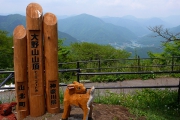
頂上の標識もリニューアルされていた
DateTime: [May 26 2012 11:53:09 (Asia/Tokyo)]
Exposures: [F Number: 5.6, Exposure Time: 1/250s, ISO: 100, Exposure Bias: -0.66Ev]
Equipments: [Focal Length: 6.3mm, Maker: Panasonic, Model: DMC-LX2]
Location: [Lat: 35° 23' 12.26" N ( 35.386740° ) , Lon: 139° 2' 56.23" E (139.048952° ) , Altitude: 751.8m ]
#09
![Check the location where this photo was taken on the web map.[ Lat.: 35.387037, Lon. : 139.049512, Alt. : 754m ]](https://y2works.net/trip/wp-content/plugins/mylightbox2/icons/map_globe_icon_gry_32.png)
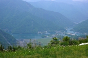
三保ダムと丹沢湖
DateTime: [May 26 2012 11:55:25 (Asia/Tokyo)]
Exposures: [F Number: 5.6, Exposure Time: 1/500s, ISO: 100, Exposure Bias: -0.66Ev]
Equipments: [Focal Length: 15.6mm, Maker: Panasonic, Model: DMC-LX2]
Location: [Lat: 35° 23' 13.33" N ( 35.387037° ) , Lon: 139° 2' 58.24" E (139.049512° ) , Altitude: 753.6m ]
#10
![Check the location where this photo was taken on the web map.[ Lat.: 35.387700, Lon. : 139.052633, Alt. : 718m ]](https://y2works.net/trip/wp-content/plugins/mylightbox2/icons/map_globe_icon_gry_32.png)
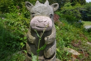
可愛らしいオブジェがいっぱい
DateTime: [May 26 2012 12:10:31 (Asia/Tokyo)]
Exposures: [F Number: 5.6, Exposure Time: 1/320s, ISO: 100, Exposure Bias: -0.66Ev]
Equipments: [Focal Length: 6.3mm, Maker: Panasonic, Model: DMC-LX2]
Location: [Lat: 35° 23' 15.72" N ( 35.387700° ) , Lon: 139° 3' 9.48" E (139.052633° ) , Altitude: 718.3m ]
#11
![Check the location where this photo was taken on the web map.[ Lat.: 35.387850, Lon. : 139.053667, Alt. : 685m ]](https://y2works.net/trip/wp-content/plugins/mylightbox2/icons/map_globe_icon_gry_32.png)
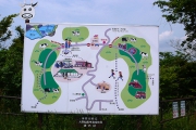
神奈川県立大野山乳牛育成牧場の案内板
DateTime: [May 26 2012 12:13:22 (Asia/Tokyo)]
Exposures: [F Number: 8.0, Exposure Time: 1/500s, ISO: 100, Exposure Bias: -0.66Ev]
Equipments: [Focal Length: 6.3mm, Maker: Panasonic, Model: DMC-LX2]
Location: [Lat: 35° 23' 16.26" N ( 35.387850° ) , Lon: 139° 3' 13.20" E (139.053667° ) , Altitude: 684.9m ]
#12
![Check the location where this photo was taken on the web map.[ Lat.: 35.372658, Lon. : 139.063947, Alt. : 347m ]](https://y2works.net/trip/wp-content/plugins/mylightbox2/icons/map_globe_icon_gry_32.png)
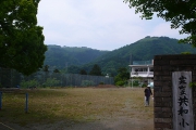
共和小学校から大野山を望む
DateTime: [May 26 2012 12:56:02 (Asia/Tokyo)]
Exposures: [F Number: 5.6, Exposure Time: 1/400s, ISO: 100, Exposure Bias: -0.66Ev]
Equipments: [Focal Length: 6.3mm, Maker: Panasonic, Model: DMC-LX2]
Location: [Lat: 35° 22' 21.57" N ( 35.372658° ) , Lon: 139° 3' 50.21" E (139.063947° ) , Altitude: 346.9m ]
今日は西丹沢の畦ヶ丸近辺で躑躅の様子でも見に行くつもりでいたが、いつものように谷峨駅からバスに乗るつもりで居たらバスの接続があまりにも悪く、西丹沢行きを断念してしまった.仕方がないので暇つぶしに大野山に行ってみることにした.天気は晴れてはいたが雲が多く視界も余り良くなかった.大野山の頂上は大勢ハイキング客で混雑している事を想像していたが、十数人程度しか居なかった.
帰りはいつものように山北駅に隣接する山北町営さくらの湯に立ち寄った.さくらの湯は北海道長万部町の二股温泉の成分を溶かし込んだ人口温泉ではあるが、2時間400円というリーズナブルな価格なので、西丹沢方面からの帰りには立ち寄っていくことを薦める.


