10
30
2011
須山口登山歩道 GPSルートマップ
須山口登山歩道 GPSルートマップ
須山浅間神社 → 忠ちゃん牧場 → 弁当場 → 水ヶ塚〔一合)[ 2011年8月15日 ]
水ヶ塚〔一合) → 御殿庭 → 宝永第一火口縁 → 富士宮口六合目[ 2011年9月24日 ]
富士宮口六合目 → 〔富士宮口ルート) → 富士宮口頂上 → 剣ヶ峰 →
御殿場口頂上 → 〔御殿場口ルート下り) → 御殿場口二合八勺避難小屋[ 2011年10月09日 ]
御殿場口二合八勺避難小屋 → 四辻(下り二合) → 須山御胎内 → 水ヶ塚〔一合)[ 2011年10月29日 ]
Map Center : [
Latitude, Longitude
, Altitude
]
Zoom Level: Bearing(Heading): Pitch: Grid Interval:
Zoom Level: Bearing(Heading): Pitch: Grid Interval:
Map Style:
Map Options:
: (
)
View Option:
Data Overlays:
#01
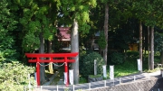
須山浅間神社
DateTime: [Aug 15 2011 09:02:19 (Asia/Tokyo)]
Exposures: [F Number: 3.2, Exposure Time: 1/100s, ISO: 100, Exposure Bias: 0.00Ev]
Equipments: [Focal Length: 6.3mm, Maker: Panasonic, Model: DMC-LX2]
Location: [Lat: 35° 15' 14.31" N ( 35.253975° ) , Lon: 138° 50' 56.01" E (138.848892° ) , Altitude: 584.0m ]
#02
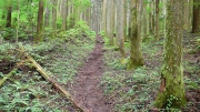
緩やかな植林地帯を抜けて行く
DateTime: [Aug 15 2011 09:41:55 (Asia/Tokyo)]
Exposures: [F Number: 2.8, Exposure Time: 1/5s, ISO: 200, Exposure Bias: 0.00Ev]
Equipments: [Focal Length: 6.3mm, Maker: Panasonic, Model: DMC-LX2]
Location: [Lat: 35° 15' 20.27" N ( 35.255630° ) , Lon: 138° 50' 2.95" E (138.834152° ) , Altitude: 714.3m ]
#03
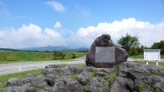
忠ちゃん牧場で視界が開ける
DateTime: [Aug 15 2011 10:10:56 (Asia/Tokyo)]
Exposures: [F Number: 5.6, Exposure Time: 1/320s, ISO: 100, Exposure Bias: 0.00Ev]
Equipments: [Focal Length: 6.3mm, Maker: Panasonic, Model: DMC-LX2]
Location: [Lat: 35° 15' 42.26" N ( 35.261738° ) , Lon: 138° 48' 59.56" E (138.816544° ) , Altitude: 863.4m ]
#04
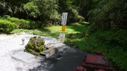
弁当場と呼ばれている給水場
DateTime: [Aug 15 2011 11:35:56 (Asia/Tokyo)]
Exposures: [F Number: 4.5, Exposure Time: 1/250s, ISO: 100, Exposure Bias: 0.00Ev]
Equipments: [Focal Length: 6.3mm, Maker: Panasonic, Model: DMC-LX2]
Location: [Lat: 35° 16' 56.51" N ( 35.282364° ) , Lon: 138° 47' 39.80" E (138.794388° ) , Altitude: 1025.6m ]
#05
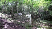
ここから登山道らしくなる
DateTime: [Aug 15 2011 12:10:47 (Asia/Tokyo)]
Exposures: [F Number: 2.8, Exposure Time: 1/60s, ISO: 320, Exposure Bias: 0.00Ev]
Equipments: [Focal Length: 6.3mm, Maker: Panasonic, Model: DMC-LX2]
Location: [Lat: 35° 17' 24.90" N ( 35.290249° ) , Lon: 138° 47' 49.74" E (138.797150° ) , Altitude: 1080.6m ]
#06
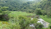
フジバラ平と呼ばれている貯水場
DateTime: [Aug 15 2011 12:35:04 (Asia/Tokyo)]
Exposures: [F Number: 4.0, Exposure Time: 1/160s, ISO: 100, Exposure Bias: 0.00Ev]
Equipments: [Focal Length: 6.3mm, Maker: Panasonic, Model: DMC-LX2]
Location: [Lat: 35° 17' 34.58" N ( 35.292938° ) , Lon: 138° 47' 17.38" E (138.788162° ) , Altitude: 1154.0m ]
#07

ゴルフ場の横を抜けて行く
DateTime: [Aug 15 2011 13:11:49 (Asia/Tokyo)]
Exposures: [F Number: 4.9, Exposure Time: 1/250s, ISO: 100, Exposure Bias: 0.00Ev]
Equipments: [Focal Length: 6.3mm, Maker: Panasonic, Model: DMC-LX2]
Location: [Lat: 35° 17' 51.74" N ( 35.297707° ) , Lon: 138° 47' 1.40" E (138.783722° ) , Altitude: 1229.9m ]
#08
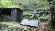
古びた水道設備
DateTime: [Aug 15 2011 13:42:53 (Asia/Tokyo)]
Exposures: [F Number: 2.8, Exposure Time: 1/20s, ISO: 200, Exposure Bias: 0.00Ev]
Equipments: [Focal Length: 6.3mm, Maker: Panasonic, Model: DMC-LX2]
Location: [Lat: 35° 18' 14.73" N ( 35.304092° ) , Lon: 138° 46' 27.84" E (138.774399° ) , Altitude: 1422.5m ]
#09
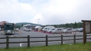
スカイラインの交通規制で水ヶ塚駐車場は賑わっていた
DateTime: [Aug 15 2011 13:59:25 (Asia/Tokyo)]
Exposures: [F Number: 5.6, Exposure Time: 1/320s, ISO: 100, Exposure Bias: 0.00Ev]
Equipments: [Focal Length: 6.3mm, Maker: Panasonic, Model: DMC-LX2]
Location: [Lat: 35° 18' 20.46" N ( 35.305683° ) , Lon: 138° 46' 9.60" E (138.769333° ) , Altitude: 1451.2m ]
#10
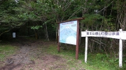
須山口登山道(上り一合)の案内板
DateTime: [Sep 24 2011 12:10:38 (Asia/Tokyo)]
Exposures: [F Number: 3.6, Exposure Time: 1/100s, ISO: 100, Exposure Bias: -0.66Ev]
Equipments: [Focal Length: 6.3mm, Maker: Panasonic, Model: DMC-LX2]
Location: [Lat: 35° 18' 22.96" N ( 35.306377° ) , Lon: 138° 46' 14.21" E (138.770615° ) , Altitude: 1453.8m ]
#11
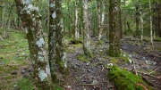
苔むした樹林地帯の中を登って行く
DateTime: [Sep 24 2011 12:47:21 (Asia/Tokyo)]
Exposures: [F Number: 2.8, Exposure Time: 1/25s, ISO: 200, Exposure Bias: -0.66Ev]
Equipments: [Focal Length: 6.3mm, Maker: Panasonic, Model: DMC-LX2]
Location: [Lat: 35° 18' 56.70" N ( 35.315750° ) , Lon: 138° 45' 33.34" E (138.759262° ) , Altitude: 1673.2m ]
#12
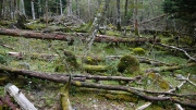
辺り一帯は倒木だらけ
DateTime: [Sep 24 2011 13:07:03 (Asia/Tokyo)]
Exposures: [F Number: 2.8, Exposure Time: 1/30s, ISO: 125, Exposure Bias: -0.66Ev]
Equipments: [Focal Length: 6.3mm, Maker: Panasonic, Model: DMC-LX2]
Location: [Lat: 35° 19' 13.03" N ( 35.320286° ) , Lon: 138° 45' 36.09" E (138.760025° ) , Altitude: 1750.8m ]
#13
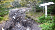
台風の爪痕が生々しい
DateTime: [Sep 24 2011 14:07:35 (Asia/Tokyo)]
Exposures: [F Number: 2.8, Exposure Time: 1/25s, ISO: 200, Exposure Bias: 0.00Ev]
Equipments: [Focal Length: 6.3mm, Maker: Panasonic, Model: DMC-LX2]
Location: [Lat: 35° 19' 45.21" N ( 35.329224° ) , Lon: 138° 45' 8.62" E (138.752396° ) , Altitude: 2081.6m ]
#14
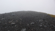
森林限界を超えるとガレ場の急斜面が続く
DateTime: [Sep 24 2011 14:46:11 (Asia/Tokyo)]
Exposures: [F Number: 5.6, Exposure Time: 1/200s, ISO: 200, Exposure Bias: 0.00Ev]
Equipments: [Focal Length: 6.3mm, Maker: Panasonic, Model: DMC-LX2]
Location: [Lat: 35° 20' 6.35" N ( 35.335098° ) , Lon: 138° 44' 48.19" E (138.746719° ) , Altitude: 2325.6m ]
#15
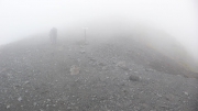
ガスっていて殆ど視界が効かない
DateTime: [Sep 24 2011 15:07:51 (Asia/Tokyo)]
Exposures: [F Number: 4.5, Exposure Time: 1/200s, ISO: 200, Exposure Bias: 0.00Ev]
Equipments: [Focal Length: 6.3mm, Maker: Panasonic, Model: DMC-LX2]
Location: [Lat: 35° 20' 20.00" N ( 35.338890° ) , Lon: 138° 44' 35.23" E (138.743118° ) , Altitude: 2466.3m ]
#16

この日は富士宮口六合目で打ち切り
DateTime: [Sep 24 2011 15:28:10 (Asia/Tokyo)]
Exposures: [F Number: 4.0, Exposure Time: 1/250s, ISO: 200, Exposure Bias: 0.00Ev]
Equipments: [Focal Length: 6.3mm, Maker: Panasonic, Model: DMC-LX2]
Location: [Lat: 35° 20' 21.02" N ( 35.339172° ) , Lon: 138° 44' 16.82" E (138.738007° ) , Altitude: 2497.3m ]
#17
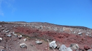
火山特有の赤茶けたスコリア
DateTime: [Oct 09 2011 11:44:06 (Asia/Tokyo)]
Exposures: [F Number: 4.9, Exposure Time: 1/200s, ISO: 100, Exposure Bias: 0.00Ev]
Equipments: [Focal Length: 6.3mm, Maker: Panasonic, Model: DMC-LX2]
Location: [Lat: 35° 20' 43.16" N ( 35.345322° ) , Lon: 138° 44' 10.95" E (138.736374° ) , Altitude: 2844.1m ]
#18
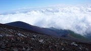
振り返ると宝永山と宝永火口が眼下に
DateTime: [Oct 09 2011 11:54:57 (Asia/Tokyo)]
Exposures: [F Number: 7.1, Exposure Time: 1/400s, ISO: 100, Exposure Bias: 0.00Ev]
Equipments: [Focal Length: 6.3mm, Maker: Panasonic, Model: DMC-LX2]
Location: [Lat: 35° 20' 49.30" N ( 35.347027° ) , Lon: 138° 44' 10.01" E (138.736115° ) , Altitude: 2942.4m ]
#19
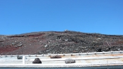
ここからはまだ頂上は見えない
DateTime: [Oct 09 2011 12:06:15 (Asia/Tokyo)]
Exposures: [F Number: 5.6, Exposure Time: 1/200s, ISO: 100, Exposure Bias: 0.00Ev]
Equipments: [Focal Length: 6.7mm, Maker: Panasonic, Model: DMC-LX2]
Location: [Lat: 35° 20' 54.56" N ( 35.348488° ) , Lon: 138° 44' 8.58" E (138.735718° ) , Altitude: 3043.9m ]
#20
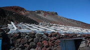
頂上の鳥居が見えてきた
DateTime: [Oct 09 2011 13:26:06 (Asia/Tokyo)]
Exposures: [F Number: 5.6, Exposure Time: 1/400s, ISO: 100, Exposure Bias: -0.66Ev]
Equipments: [Focal Length: 6.3mm, Maker: Panasonic, Model: DMC-LX2]
Location: [Lat: 35° 21' 23.60" N ( 35.356556° ) , Lon: 138° 43' 51.88" E (138.731079° ) , Altitude: 3543.6m ]
#21
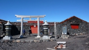
富士宮口頂上に到着
DateTime: [Oct 09 2011 13:56:25 (Asia/Tokyo)]
Exposures: [F Number: 6.3, Exposure Time: 1/400s, ISO: 100, Exposure Bias: -0.33Ev]
Equipments: [Focal Length: 6.3mm, Maker: Panasonic, Model: DMC-LX2]
Location: [Lat: 35° 21' 34.40" N ( 35.359554° ) , Lon: 138° 43' 52.16" E (138.731155° ) , Altitude: 3719.7m ]
#22
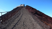
剣ヶ峰へは馬ノ背と呼ばれる急斜面を登って行く
DateTime: [Oct 09 2011 14:08:37 (Asia/Tokyo)]
Exposures: [F Number: 5.6, Exposure Time: 1/200s, ISO: 100, Exposure Bias: -0.33Ev]
Equipments: [Focal Length: 6.3mm, Maker: Panasonic, Model: DMC-LX2]
Location: [Lat: 35° 21' 35.48" N ( 35.359856° ) , Lon: 138° 43' 42.00" E (138.728333° ) , Altitude: 3729.8m ]
#23
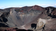
大内院と呼ばれている頂上火口
DateTime: [Oct 09 2011 14:14:01 (Asia/Tokyo)]
Exposures: [F Number: 5.6, Exposure Time: 1/400s, ISO: 100, Exposure Bias: -0.33Ev]
Equipments: [Focal Length: 6.3mm, Maker: Panasonic, Model: DMC-LX2]
Location: [Lat: 35° 21' 37.80" N ( 35.360500° ) , Lon: 138° 43' 39.53" E (138.727646° ) , Altitude: 3758.6m ]
#24
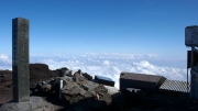
今日は日本最高峰の石碑を独り占め
DateTime: [Oct 09 2011 14:22:20 (Asia/Tokyo)]
Exposures: [F Number: 8.0, Exposure Time: 1/500s, ISO: 100, Exposure Bias: -0.33Ev]
Equipments: [Focal Length: 6.3mm, Maker: Panasonic, Model: DMC-LX2]
Location: [Lat: 35° 21' 38.38" N ( 35.360661° ) , Lon: 138° 43' 38.54" E (138.727371° ) , Altitude: 3783.2m ]
#25
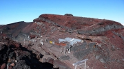
御殿場口の頂上へ向かう
DateTime: [Oct 09 2011 14:33:07 (Asia/Tokyo)]
Exposures: [F Number: 5.6, Exposure Time: 1/320s, ISO: 100, Exposure Bias: -0.33Ev]
Equipments: [Focal Length: 6.3mm, Maker: Panasonic, Model: DMC-LX2]
Location: [Lat: 35° 21' 34.77" N ( 35.359657° ) , Lon: 138° 43' 53.26" E (138.731461° ) , Altitude: 3725.2m ]
#26
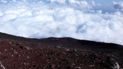
下界は厚い雲の中
DateTime: [Oct 09 2011 14:47:20 (Asia/Tokyo)]
Exposures: [F Number: 7.1, Exposure Time: 1/400s, ISO: 100, Exposure Bias: -0.33Ev]
Equipments: [Focal Length: 6.3mm, Maker: Panasonic, Model: DMC-LX2]
Location: [Lat: 35° 21' 33.67" N ( 35.359352° ) , Lon: 138° 43' 59.25" E (138.733124° ) , Altitude: 3676.9m ]
#27
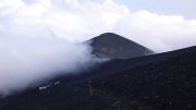
宝永山が近づいてきた
DateTime: [Oct 09 2011 15:52:07 (Asia/Tokyo)]
Exposures: [F Number: 5.6, Exposure Time: 1/320s, ISO: 100, Exposure Bias: -0.33Ev]
Equipments: [Focal Length: 11.6mm, Maker: Panasonic, Model: DMC-LX2]
Location: [Lat: 35° 21' 5.05" N ( 35.351402° ) , Lon: 138° 44' 55.83" E (138.748840° ) , Altitude: 2832.6m ]
#28
雲の中へ突入
DateTime: [Oct 09 2011 16:03:01 (Asia/Tokyo)]
Exposures: [F Number: 4.9, Exposure Time: 1/250s, ISO: 100, Exposure Bias: -0.33Ev]
Equipments: [Focal Length: 6.3mm, Maker: Panasonic, Model: DMC-LX2]
Location: [Lat: 35° 20' 53.16" N ( 35.348099° ) , Lon: 138° 45' 6.87" E (138.751907° ) , Altitude: 2673.2m ]
#29
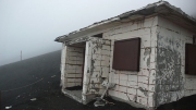
旧二合八勺の気象庁避難小屋
DateTime: [Oct 09 2011 16:21:00 (Asia/Tokyo)]
Exposures: [F Number: 2.8, Exposure Time: 1/200s, ISO: 200, Exposure Bias: -0.33Ev]
Equipments: [Focal Length: 6.3mm, Maker: Panasonic, Model: DMC-LX2]
Location: [Lat: 35° 20' 35.34" N ( 35.343151° ) , Lon: 138° 46' 1.80" E (138.767166° ) , Altitude: 2100.8m ]
#30
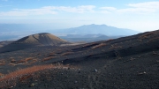
ここから須山口下山道が始まる
DateTime: [Oct 29 2011 13:40:26 (Asia/Tokyo)]
Exposures: [F Number: 5.6, Exposure Time: 1/400s, ISO: 100, Exposure Bias: -0.66Ev]
Equipments: [Focal Length: 6.3mm, Maker: Panasonic, Model: DMC-LX2]
Location: [Lat: 35° 20' 21.87" N ( 35.339409° ) , Lon: 138° 46' 2.90" E (138.767471° ) , Altitude: 2004.0m ]
#31
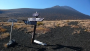
四辻(下り二合)から宝永山と頂上を見上げる
DateTime: [Oct 29 2011 13:54:26 (Asia/Tokyo)]
Exposures: [F Number: 5.6, Exposure Time: 1/250s, ISO: 100, Exposure Bias: -0.66Ev]
Equipments: [Focal Length: 6.3mm, Maker: Panasonic, Model: DMC-LX2]
Location: [Lat: 35° 19' 54.08" N ( 35.331688° ) , Lon: 138° 46' 19.10" E (138.771973° ) , Altitude: 1801.2m ]
#32
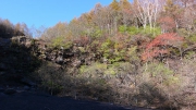
幕岩と呼ばれる巨大な岩
DateTime: [Oct 29 2011 14:13:21 (Asia/Tokyo)]
Exposures: [F Number: 4.5, Exposure Time: 1/200s, ISO: 100, Exposure Bias: -0.66Ev]
Equipments: [Focal Length: 6.3mm, Maker: Panasonic, Model: DMC-LX2]
Location: [Lat: 35° 19' 31.95" N ( 35.325542° ) , Lon: 138° 46' 24.32" E (138.773422° ) , Altitude: 1650.4m ]
#33
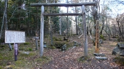
須山御胎内
DateTime: [Oct 29 2011 14:48:54 (Asia/Tokyo)]
Exposures: [F Number: 2.8, Exposure Time: 1/40s, ISO: 100, Exposure Bias: -0.66Ev]
Equipments: [Focal Length: 6.3mm, Maker: Panasonic, Model: DMC-LX2]
Location: [Lat: 35° 19' 3.57" N ( 35.317657° ) , Lon: 138° 46' 47.61" E (138.779892° ) , Altitude: 1470.9m ]
#34
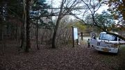
須山口登山道(上り一合)に戻ってきた
DateTime: [Oct 29 2011 15:27:13 (Asia/Tokyo)]
Exposures: [F Number: 2.8, Exposure Time: 1/80s, ISO: 100, Exposure Bias: -0.66Ev]
Equipments: [Focal Length: 6.3mm, Maker: Panasonic, Model: DMC-LX2]
Location: [Lat: 35° 18' 23.21" N ( 35.306446° ) , Lon: 138° 46' 13.66" E (138.770462° ) , Altitude: 1468.9m ]
#35
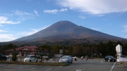
水ヶ塚駐車場からの眺め
DateTime: [Oct 29 2011 15:30:43 (Asia/Tokyo)]
Exposures: [F Number: 5.6, Exposure Time: 1/250s, ISO: 100, Exposure Bias: -0.66Ev]
Equipments: [Focal Length: 7.5mm, Maker: Panasonic, Model: DMC-LX2]
Location: [Lat: 35° 18' 19.22" N ( 35.305340° ) , Lon: 138° 46' 14.49" E (138.770691° ) , Altitude: 1450.5m ]
