コマドリ君を探しに利尻へ
1日目(5/25)
#01
![Check the location where this photo was taken on the web map.[ Lat.: 43.068492, Lon. : 141.349961, Alt. : 34m ]](https://y2works.net/trip/wp-content/plugins/mylightbox2/icons/map_globe_icon_gry_32.png)
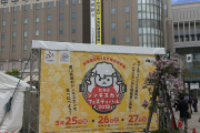
札幌駅前ではジンギスカン祭りが行われていた
DateTime: [May 25 2018 10:58:26 (Asia/Tokyo)]
Exposures: [F Number: 2.2, Exposure Time: 1/1399s, ISO: 25, Exposure Bias: 0.00Ev]
Equipments: [Focal Length: 4.2mm, Maker: Apple, Model: iPhone SE]
Location: [Lat: 43° 4' 6.57" N ( 43.068492° ) , Lon: 141° 20' 59.86" E (141.349961° ) , Altitude: 33.6m, Direction: 328° T ]
#02
![Check the location where this photo was taken on the web map.[ Lat.: 45.247094, Lon. : 141.219344, Alt. : 15m ]](https://y2works.net/trip/wp-content/plugins/mylightbox2/icons/map_globe_icon_gry_32.png)
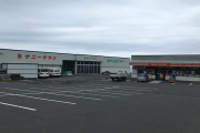
キャンプ場へ向かう途中でセイコーマートで食料を調達する
DateTime: [May 26 2018 08:41:58 (Asia/Tokyo)]
Exposures: [F Number: 2.2, Exposure Time: 1/1374s, ISO: 25, Exposure Bias: 0.00Ev]
Equipments: [Focal Length: 4.2mm, Maker: Apple, Model: iPhone SE]
Location: [Lat: 45° 14' 49.54" N ( 45.247094° ) , Lon: 141° 13' 9.64" E (141.219344° ) , Altitude: 14.7m, Direction: 3° T ]
#03
![Check the location where this photo was taken on the web map.[ Lat.: 45.240953, Lon. : 141.217347, Alt. : 38m ]](https://y2works.net/trip/wp-content/plugins/mylightbox2/icons/map_globe_icon_gry_32.png)
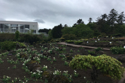
温泉プール下の公園にある高山植物園
DateTime: [May 26 2018 09:06:22 (Asia/Tokyo)]
Exposures: [F Number: 2.2, Exposure Time: 1/1183s, ISO: 25, Exposure Bias: 0.00Ev]
Equipments: [Focal Length: 4.2mm, Maker: Apple, Model: iPhone SE]
Location: [Lat: 45° 14' 27.43" N ( 45.240953° ) , Lon: 141° 13' 2.45" E (141.217347° ) , Altitude: 38.5m, Direction: 63° T ]
#04

![Check the location where this photo was taken on the web map.[ Lat.: 45.240550, Lon. : 141.217789, Alt. : 38m ]](https://y2works.net/trip/wp-content/plugins/mylightbox2/icons/map_globe_icon_gry_32.png)
利尻は丁度桜のシーズンだった
DateTime: [May 26 2018 09:08:07 (Asia/Tokyo)]
Exposures: [F Number: 2.2, Exposure Time: 1/680s, ISO: 25, Exposure Bias: 0.00Ev]
Equipments: [Focal Length: 4.2mm, Maker: Apple, Model: iPhone SE]
Location: [Lat: 45° 14' 25.98" N ( 45.240550° ) , Lon: 141° 13' 4.04" E (141.217789° ) , Altitude: 37.7m, Direction: 312° T ]
#05

![Check the location where this photo was taken on the web map.[ Lat.: 45.240453, Lon. : 141.217772, Alt. : 38m ]](https://y2works.net/trip/wp-content/plugins/mylightbox2/icons/map_globe_icon_gry_32.png)
こちらは八重桜だろうか
DateTime: [May 26 2018 09:08:26 (Asia/Tokyo)]
Exposures: [F Number: 2.2, Exposure Time: 1/1166s, ISO: 25, Exposure Bias: 0.00Ev]
Equipments: [Focal Length: 4.2mm, Maker: Apple, Model: iPhone SE]
Location: [Lat: 45° 14' 25.63" N ( 45.240453° ) , Lon: 141° 13' 3.98" E (141.217772° ) , Altitude: 37.6m, Direction: 310° T ]
#06

白から段々とピンク色に花びらが染まって行くのかな
DateTime: [May 26 2018 09:08:43 (Asia/Tokyo)]
Exposures: [F Number: 2.2, Exposure Time: 1/381s, ISO: 25, Exposure Bias: 0.00Ev]
Equipments: [Focal Length: 4.2mm, Maker: Apple, Model: iPhone SE]
#07
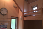
今回はテントではなく4人用バンガローを借りた
DateTime: [May 26 2018 09:31:18 (Asia/Tokyo)]
Exposures: [F Number: 2.2, Exposure Time: 1/30s, ISO: 125, Exposure Bias: 0.00Ev]
Equipments: [Focal Length: 4.2mm, Maker: Apple, Model: iPhone SE]
#08
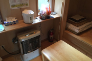
![Check the location where this photo was taken on the web map.[ Lat.: 45.238517, Lon. : 141.216706, Alt. : 58m ]](https://y2works.net/trip/wp-content/plugins/mylightbox2/icons/map_globe_icon_gry_32.png)
電気ポット、FF型石油ストーブ、布団セットまで備わって5,000円/日はリーズナブル
DateTime: [May 26 2018 09:31:22 (Asia/Tokyo)]
Exposures: [F Number: 2.2, Exposure Time: 1/30s, ISO: 200, Exposure Bias: 0.00Ev]
Equipments: [Focal Length: 4.2mm, Maker: Apple, Model: iPhone SE]
Location: [Lat: 45° 14' 18.66" N ( 45.238517° ) , Lon: 141° 13' 0.14" E (141.216706° ) , Altitude: 57.7m, Direction: 28° T ]
#09
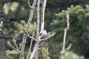
遠すぎて上手く撮れなかったけど紛れもなくシマエナガちゃんだ!!!
DateTime: [May 26 2018 10:22:39 (Asia/Tokyo)]
Exposures: [F Number: 0.0, Exposure Time: 1/200s, ISO: 800, Exposure Bias: -0.30Ev]
Equipments: [Focal Length: 500.0mm, Maker: PENTAX , Model: PENTAX K-5 II s ]
#10
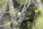
こんなところで出会えるとは...
DateTime: [May 26 2018 10:22:47 (Asia/Tokyo)]
Exposures: [F Number: 0.0, Exposure Time: 1/320s, ISO: 800, Exposure Bias: -0.30Ev]
Equipments: [Focal Length: 500.0mm, Maker: PENTAX , Model: PENTAX K-5 II s ]
これまで何度となく利尻を訪れているが、利尻山に登ることが目的だったため利尻島内を散策したことがなかった.残雪の利尻山とコマドリを見たくて5月中に利尻を訪れることにした.利尻では5月下旬は丁度桜の季節で、島内のあちこちで桜の花が咲いていた.
稚内行きの便が満席だったので、札幌経由で夜行バスを利用して稚内入りした。朝一番のフェリーで利尻へ向かうが、平日ということもあり鴛泊行きのフェリーは閑散としていた.対照的に礼文島行きのフェリーはツアーの団体で長い行列ができていた.
鴛泊フェリーターミナルから、いつも利用しているキャンプ場ゆーにへと向かうが、セイコーマート(北海道でコンビニと言えば先ずはセイコーマートというくらい代表的な存在)に寄って食料を調達した.隣にホームセンターがあり、ガス缶(SOTOも置いてあった)も売っているので、稚内でガス缶を入手し損なった場合はここで買うと良いだろう.
キャンプ場の手前にある町営の温泉プールの裏手の林からコマドリがさえずりが聞こえている.こんな場所でいきなりコマドリ君に遭遇するとは思っても見なかった.コマドリはクマザサの藪の中に隠れているので、その姿を確認することは容易ではない.
キャンプ場の周辺からもコマドリのさえずりがあちらこちらから聞こえてくる.利尻島では普通にコマドリが観察できるとは聞いていたが、あまりのコマドリの多さにちょっと拍子抜けしてしまった.
初日はぐずついた天気だったため、登山道周辺での探鳥は諦めてキャンプ場の周辺をカメラを持ってお散歩することにした.サイクリング道路の下の方にある森の方からコマドリに混じってジュルジュルという聞き覚えのある鳴き声がしたので、木々の枝の上を探してみたら、白っぽい小さな鳥が枝から枝へと忙しなく飛び回っていた.肉眼では距離が遠すぎて何の鳥か判らなかったが、双眼鏡で確認すると紛れもなくシマエナガちゃんだった.
なかなか出会えなかったシマエナガちゃんとも出会うことができて幸先が良い鳥見旅になりそうで期待が膨らむ.
2日目(5/27) 姫沼ハイキングコースを
#01

![Check the location where this photo was taken on the web map.[ Lat.: 45.235788, Lon. : 141.213980, Alt. : 110m ]](https://y2works.net/trip/wp-content/plugins/mylightbox2/icons/map_globe_icon_gry_32.png)
電線の上でさえずっているのは
DateTime: [May 27 2018 04:58:59 (Asia/Tokyo)]
Exposures: [F Number: 0.0, Exposure Time: 1/1600s, ISO: 800, Exposure Bias: -0.30Ev]
Equipments: [Focal Length: 500.0mm, Maker: PENTAX , Model: PENTAX K-5 II s ]
Location: [Lat: 45° 14' 8.84" N ( 45.235788° ) , Lon: 141° 12' 50.33" E (141.213980° ) , Altitude: 110.3m, Direction: 183° T ]
#02
![Check the location where this photo was taken on the web map.[ Lat.: 45.227205, Lon. : 141.214090, Alt. : 148m ]](https://y2works.net/trip/wp-content/plugins/mylightbox2/icons/map_globe_icon_gry_32.png)
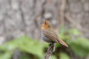
不意打ちでコマドリ君が目の前に現れてあたふた
DateTime: [May 27 2018 05:27:45 (Asia/Tokyo)]
Exposures: [F Number: 0.0, Exposure Time: 1/80s, ISO: 1,600, Exposure Bias: -0.30Ev]
Equipments: [Focal Length: 500.0mm, Maker: PENTAX , Model: PENTAX K-5 II s ]
Location: [Lat: 45° 13' 37.94" N ( 45.227205° ) , Lon: 141° 12' 50.72" E (141.214090° ) , Altitude: 147.9m, Direction: 294° T ]
#03
![Check the location where this photo was taken on the web map.[ Lat.: 45.227255, Lon. : 141.214073, Alt. : 150m ]](https://y2works.net/trip/wp-content/plugins/mylightbox2/icons/map_globe_icon_gry_32.png)
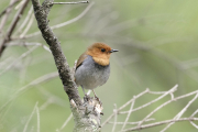
コマドリ君やミソッチのさえずり合戦が始まった
DateTime: [May 27 2018 05:32:23 (Asia/Tokyo)]
Exposures: [F Number: 0.0, Exposure Time: 1/60s, ISO: 800, Exposure Bias: -0.30Ev]
Equipments: [Focal Length: 500.0mm, Maker: PENTAX , Model: PENTAX K-5 II s ]
Location: [Lat: 45° 13' 38.12" N ( 45.227255° ) , Lon: 141° 12' 50.66" E (141.214073° ) , Altitude: 150.4m, Direction: 294° T ]
#04
![Check the location where this photo was taken on the web map.[ Lat.: 45.226725, Lon. : 141.213997, Alt. : 165m ]](https://y2works.net/trip/wp-content/plugins/mylightbox2/icons/map_globe_icon_gry_32.png)
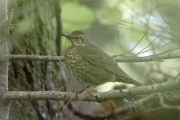
木の葉の陰で綺麗に撮れなかったけどビンズイ君かな?
DateTime: [May 27 2018 05:38:55 (Asia/Tokyo)]
Exposures: [F Number: 0.0, Exposure Time: 1/30s, ISO: 800, Exposure Bias: -0.30Ev]
Equipments: [Focal Length: 500.0mm, Maker: PENTAX , Model: PENTAX K-5 II s ]
Location: [Lat: 45° 13' 36.21" N ( 45.226725° ) , Lon: 141° 12' 50.39" E (141.213997° ) , Altitude: 165.1m, Direction: 219° T ]
#05
![Check the location where this photo was taken on the web map.[ Lat.: 45.221720, Lon. : 141.222460, Alt. : 400m ]](https://y2works.net/trip/wp-content/plugins/mylightbox2/icons/map_globe_icon_gry_32.png)
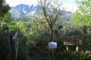
大ポン山、小ポン山と姫沼への分岐点
DateTime: [May 27 2018 06:23:14 (Asia/Tokyo)]
Exposures: [F Number: 3.2, Exposure Time: 1/200s, ISO: 80, Exposure Bias: 0.00Ev]
Equipments: [Focal Length: 6.0mm, Maker: RICOH , Model: GR DIGITAL 4 ]
Location: [Lat: 45° 13' 18.19" N ( 45.221720° ) , Lon: 141° 13' 20.86" E (141.222460° ) , Altitude: 399.6m ]
#06
![Check the location where this photo was taken on the web map.[ Lat.: 45.223432, Lon. : 141.222400, Alt. : 459m ]](https://y2works.net/trip/wp-content/plugins/mylightbox2/icons/map_globe_icon_gry_32.png)
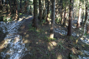
大ポン山の手前にはまだ雪が残っていた
DateTime: [May 27 2018 06:31:59 (Asia/Tokyo)]
Exposures: [F Number: 1.9, Exposure Time: 1/50s, ISO: 80, Exposure Bias: -0.70Ev]
Equipments: [Focal Length: 6.0mm, Maker: RICOH , Model: GR DIGITAL 4 ]
Location: [Lat: 45° 13' 24.36" N ( 45.223432° ) , Lon: 141° 13' 20.64" E (141.222400° ) , Altitude: 459.2m ]
#07
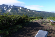
![Check the location where this photo was taken on the web map.[ Lat.: 45.223268, Lon. : 141.220273, Alt. : 480m ]](https://y2works.net/trip/wp-content/plugins/mylightbox2/icons/map_globe_icon_gry_32.png)
大ポン山の頂上は視界が開けている
DateTime: [May 27 2018 06:34:54 (Asia/Tokyo)]
Exposures: [F Number: 4.0, Exposure Time: 1/320s, ISO: 80, Exposure Bias: -0.70Ev]
Equipments: [Focal Length: 6.0mm, Maker: RICOH , Model: GR DIGITAL 4 ]
Location: [Lat: 45° 13' 23.77" N ( 45.223268° ) , Lon: 141° 13' 12.98" E (141.220273° ) , Altitude: 479.8m ]
#08
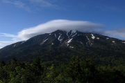
![Check the location where this photo was taken on the web map.[ Lat.: 45.223153, Lon. : 141.220178, Alt. : 481m ]](https://y2works.net/trip/wp-content/plugins/mylightbox2/icons/map_globe_icon_gry_32.png)
笠雲を纏った利尻山
DateTime: [May 27 2018 06:35:10 (Asia/Tokyo)]
Exposures: [F Number: 6.3, Exposure Time: 1/800s, ISO: 80, Exposure Bias: -1.00Ev]
Equipments: [Focal Length: 6.0mm, Maker: RICOH , Model: GR DIGITAL 4 ]
Location: [Lat: 45° 13' 23.35" N ( 45.223153° ) , Lon: 141° 13' 12.64" E (141.220178° ) , Altitude: 480.8m ]
#09
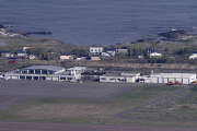
![Check the location where this photo was taken on the web map.[ Lat.: 45.223130, Lon. : 141.220157, Alt. : 440m ]](https://y2works.net/trip/wp-content/plugins/mylightbox2/icons/map_globe_icon_gry_32.png)
望遠レンズで利尻空港を狙う
DateTime: [May 27 2018 06:38:32 (Asia/Tokyo)]
Exposures: [F Number: 0.0, Exposure Time: 1/2500s, ISO: 800, Exposure Bias: -0.30Ev]
Equipments: [Focal Length: 500.0mm, Maker: PENTAX , Model: PENTAX K-5 II s ]
Location: [Lat: 45° 13' 23.27" N ( 45.223130° ) , Lon: 141° 13' 12.56" E (141.220157° ) , Altitude: 439.9m, Direction: 325° T ]
#10
![Check the location where this photo was taken on the web map.[ Lat.: 45.222232, Lon. : 141.229747, Alt. : 447m ]](https://y2works.net/trip/wp-content/plugins/mylightbox2/icons/map_globe_icon_gry_32.png)
小ポン山の頂上からは何も見えない
DateTime: [May 27 2018 06:53:00 (Asia/Tokyo)]
Exposures: [F Number: 3.5, Exposure Time: 1/250s, ISO: 80, Exposure Bias: -1.00Ev]
Equipments: [Focal Length: 6.0mm, Maker: RICOH , Model: GR DIGITAL 4 ]
Location: [Lat: 45° 13' 20.04" N ( 45.222232° ) , Lon: 141° 13' 47.09" E (141.229747° ) , Altitude: 447.1m ]
#11

![Check the location where this photo was taken on the web map.[ Lat.: 45.222309, Lon. : 141.227980, Alt. : 416m ]](https://y2works.net/trip/wp-content/plugins/mylightbox2/icons/map_globe_icon_gry_32.png)
ハイキングコースにいっぱい咲いていたリンドウ系の花
DateTime: [May 27 2018 06:57:26 (Asia/Tokyo)]
Exposures: [F Number: 2.2, Exposure Time: 1/125s, ISO: 80, Exposure Bias: -0.70Ev]
Equipments: [Focal Length: 6.0mm, Maker: RICOH , Model: GR DIGITAL 4 ]
Location: [Lat: 45° 13' 20.31" N ( 45.222309° ) , Lon: 141° 13' 40.73" E (141.227980° ) , Altitude: 416.4m ]
#12
![Check the location where this photo was taken on the web map.[ Lat.: 45.225797, Lon. : 141.246797, Alt. : 155m ]](https://y2works.net/trip/wp-content/plugins/mylightbox2/icons/map_globe_icon_gry_32.png)
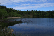
こぢんまりとした姫沼
DateTime: [May 27 2018 08:27:42 (Asia/Tokyo)]
Exposures: [F Number: 5.0, Exposure Time: 1/640s, ISO: 80, Exposure Bias: -0.70Ev]
Equipments: [Focal Length: 6.0mm, Maker: RICOH , Model: GR DIGITAL 4 ]
Location: [Lat: 45° 13' 32.87" N ( 45.225797° ) , Lon: 141° 14' 48.47" E (141.246797° ) , Altitude: 155.4m ]
#13
![Check the location where this photo was taken on the web map.[ Lat.: 45.227677, Lon. : 141.246175, Alt. : 135m ]](https://y2works.net/trip/wp-content/plugins/mylightbox2/icons/map_globe_icon_gry_32.png)
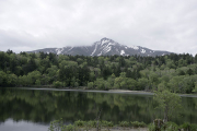
晴れていれば水面に反射した綺麗な利尻山が見られるそうだ
DateTime: [May 27 2018 08:40:01 (Asia/Tokyo)]
Exposures: [F Number: 3.5, Exposure Time: 1/2000s, ISO: 200, Exposure Bias: -0.30Ev]
Equipments: [Focal Length: 21.0mm, Maker: PENTAX , Model: PENTAX K-5 II s ]
Location: [Lat: 45° 13' 39.64" N ( 45.227677° ) , Lon: 141° 14' 46.23" E (141.246175° ) , Altitude: 135.4m, Direction: 167° T ]
#14
![Check the location where this photo was taken on the web map.[ Lat.: 45.221441, Lon. : 141.241098, Alt. : 254m ]](https://y2works.net/trip/wp-content/plugins/mylightbox2/icons/map_globe_icon_gry_32.png)
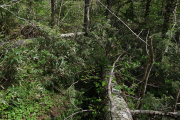
利尻のハイキングコースは倒木だらけ
DateTime: [May 27 2018 09:30:58 (Asia/Tokyo)]
Exposures: [F Number: 4.0, Exposure Time: 1/320s, ISO: 80, Exposure Bias: -1.00Ev]
Equipments: [Focal Length: 6.0mm, Maker: RICOH , Model: GR DIGITAL 4 ]
Location: [Lat: 45° 13' 17.19" N ( 45.221441° ) , Lon: 141° 14' 27.95" E (141.241098° ) , Altitude: 253.9m ]
#15
![Check the location where this photo was taken on the web map.[ Lat.: 45.227377, Lon. : 141.213843, Alt. : 211m ]](https://y2works.net/trip/wp-content/plugins/mylightbox2/icons/map_globe_icon_gry_32.png)
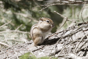
しぐさが可愛いシマリス君
DateTime: [May 27 2018 11:57:56 (Asia/Tokyo)]
Exposures: [F Number: 0.0, Exposure Time: 1/400s, ISO: 800, Exposure Bias: -0.30Ev]
Equipments: [Focal Length: 500.0mm, Maker: PENTAX , Model: PENTAX K-5 II s ]
Location: [Lat: 45° 13' 38.56" N ( 45.227377° ) , Lon: 141° 12' 49.84" E (141.213843° ) , Altitude: 211.1m, Direction: 307° T ]
#16
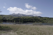
![Check the location where this photo was taken on the web map.[ Lat.: 45.118275, Lon. : 141.285927, Alt. : 5m ]](https://y2works.net/trip/wp-content/plugins/mylightbox2/icons/map_globe_icon_gry_32.png)
利尻島の南側にあるオタトマリ沼へ行ってみた
DateTime: [May 27 2018 15:01:09 (Asia/Tokyo)]
Exposures: [F Number: 11.0, Exposure Time: 1/160s, ISO: 100, Exposure Bias: -0.30Ev]
Equipments: [Focal Length: 21.0mm, Maker: PENTAX , Model: PENTAX K-5 II s ]
Location: [Lat: 45° 7' 5.79" N ( 45.118275° ) , Lon: 141° 17' 9.34" E (141.285927° ) , Altitude: 4.6m, Direction: 1° T ]
#17
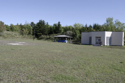
![Check the location where this photo was taken on the web map.[ Lat.: 45.122448, Lon. : 141.288842, Alt. : 28m ]](https://y2works.net/trip/wp-content/plugins/mylightbox2/icons/map_globe_icon_gry_32.png)
沼浦キャンプ場の水道施設は何故か閉鎖中
DateTime: [May 27 2018 15:36:25 (Asia/Tokyo)]
Exposures: [F Number: 5.6, Exposure Time: 1/500s, ISO: 100, Exposure Bias: -0.70Ev]
Equipments: [Focal Length: 21.0mm, Maker: PENTAX , Model: PENTAX K-5 II s ]
Location: [Lat: 45° 7' 20.81" N ( 45.122448° ) , Lon: 141° 17' 19.83" E (141.288842° ) , Altitude: 28.2m, Direction: 135° T ]
#18
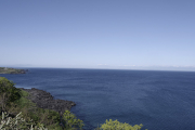
![Check the location where this photo was taken on the web map.[ Lat.: 45.117043, Lon. : 141.289930, Alt. : 51m ]](https://y2works.net/trip/wp-content/plugins/mylightbox2/icons/map_globe_icon_gry_32.png)
遠くに天塩半島を望む
DateTime: [May 27 2018 15:45:28 (Asia/Tokyo)]
Exposures: [F Number: 14.0, Exposure Time: 1/200s, ISO: 100, Exposure Bias: -0.70Ev]
Equipments: [Focal Length: 21.0mm, Maker: PENTAX , Model: PENTAX K-5 II s ]
Location: [Lat: 45° 7' 1.36" N ( 45.117043° ) , Lon: 141° 17' 23.75" E (141.289930° ) , Altitude: 51.4m, Direction: 71° T ]
#19
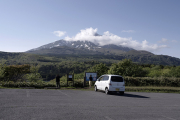
![Check the location where this photo was taken on the web map.[ Lat.: 45.116740, Lon. : 141.289565, Alt. : 43m ]](https://y2works.net/trip/wp-content/plugins/mylightbox2/icons/map_globe_icon_gry_32.png)
沼裏展望台(某お菓子メーカーのパッケージ写真で有名だそうな...)
DateTime: [May 27 2018 15:47:26 (Asia/Tokyo)]
Exposures: [F Number: 7.1, Exposure Time: 1/400s, ISO: 100, Exposure Bias: -0.70Ev]
Equipments: [Focal Length: 21.0mm, Maker: PENTAX , Model: PENTAX K-5 II s ]
Location: [Lat: 45° 7' 0.26" N ( 45.116740° ) , Lon: 141° 17' 22.43" E (141.289565° ) , Altitude: 43.0m, Direction: 355° T ]
#20
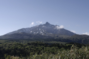
![Check the location where this photo was taken on the web map.[ Lat.: 45.119418, Lon. : 141.288465, Alt. : 44m ]](https://y2works.net/trip/wp-content/plugins/mylightbox2/icons/map_globe_icon_gry_32.png)
やっと雲が減ってきて頂上が見えてきた
DateTime: [May 27 2018 16:17:29 (Asia/Tokyo)]
Exposures: [F Number: 6.3, Exposure Time: 1/1000s, ISO: 100, Exposure Bias: -1.30Ev]
Equipments: [Focal Length: 21.0mm, Maker: PENTAX , Model: PENTAX K-5 II s ]
Location: [Lat: 45° 7' 9.91" N ( 45.119418° ) , Lon: 141° 17' 18.47" E (141.288465° ) , Altitude: 43.6m, Direction: 359° T ]
#21
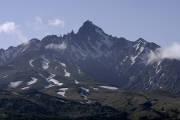
![Check the location where this photo was taken on the web map.[ Lat.: 45.119433, Lon. : 141.288485, Alt. : 42m ]](https://y2works.net/trip/wp-content/plugins/mylightbox2/icons/map_globe_icon_gry_32.png)
島の南側から見る利尻山は険しい表情を見せる
DateTime: [May 27 2018 16:18:30 (Asia/Tokyo)]
Exposures: [F Number: 10.0, Exposure Time: 1/500s, ISO: 100, Exposure Bias: -1.30Ev]
Equipments: [Focal Length: 100.0mm, Maker: PENTAX , Model: PENTAX K-5 II s ]
Location: [Lat: 45° 7' 9.96" N ( 45.119433° ) , Lon: 141° 17' 18.55" E (141.288485° ) , Altitude: 42.0m, Direction: 359° T ]
#22
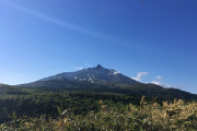
![Check the location where this photo was taken on the web map.[ Lat.: 45.119403, Lon. : 141.288453, Alt. : 42m ]](https://y2works.net/trip/wp-content/plugins/mylightbox2/icons/map_globe_icon_gry_32.png)
オタトマリ沼の上空は海鳥が飛び交っている
DateTime: [May 27 2018 16:20:42 (Asia/Tokyo)]
Exposures: [F Number: 2.2, Exposure Time: 1/2024s, ISO: 25, Exposure Bias: 0.00Ev]
Equipments: [Focal Length: 4.2mm, Maker: Apple, Model: iPhone SE]
Location: [Lat: 45° 7' 9.85" N ( 45.119403° ) , Lon: 141° 17' 18.43" E (141.288453° ) , Altitude: 41.9m, Direction: 320° T ]
#23
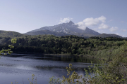
![Check the location where this photo was taken on the web map.[ Lat.: 45.119335, Lon. : 141.287365, Alt. : 31m ]](https://y2works.net/trip/wp-content/plugins/mylightbox2/icons/map_globe_icon_gry_32.png)
風が強く水面が荒れているので、逆さ利尻富士は望めなかった
DateTime: [May 27 2018 16:26:41 (Asia/Tokyo)]
Exposures: [F Number: 6.3, Exposure Time: 1/500s, ISO: 100, Exposure Bias: -1.00Ev]
Equipments: [Focal Length: 21.0mm, Maker: PENTAX , Model: PENTAX K-5 II s ]
Location: [Lat: 45° 7' 9.61" N ( 45.119335° ) , Lon: 141° 17' 14.51" E (141.287365° ) , Altitude: 30.5m, Direction: 356° T ]
#24
![Check the location where this photo was taken on the web map.[ Lat.: 45.251875, Lon. : 141.214137, Alt. : 65m ]](https://y2works.net/trip/wp-content/plugins/mylightbox2/icons/map_globe_icon_gry_32.png)
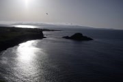
夕日ヶ丘展望台から礼文島を望む
DateTime: [May 27 2018 17:40:49 (Asia/Tokyo)]
Exposures: [F Number: 3.5, Exposure Time: 1/8000s, ISO: 100, Exposure Bias: -2.30Ev]
Equipments: [Focal Length: 21.0mm, Maker: PENTAX , Model: PENTAX K-5 II s ]
Location: [Lat: 45° 15' 6.75" N ( 45.251875° ) , Lon: 141° 12' 50.89" E (141.214137° ) , Altitude: 64.9m, Direction: 333° T ]
#25
![Check the location where this photo was taken on the web map.[ Lat.: 45.251935, Lon. : 141.214315, Alt. : 66m ]](https://y2works.net/trip/wp-content/plugins/mylightbox2/icons/map_globe_icon_gry_32.png)
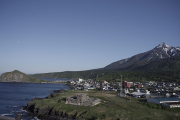
ペシ岬と鴛泊の街並み
DateTime: [May 27 2018 17:41:38 (Asia/Tokyo)]
Exposures: [F Number: 3.5, Exposure Time: 1/6400s, ISO: 100, Exposure Bias: -2.30Ev]
Equipments: [Focal Length: 21.0mm, Maker: PENTAX , Model: PENTAX K-5 II s ]
Location: [Lat: 45° 15' 6.97" N ( 45.251935° ) , Lon: 141° 12' 51.53" E (141.214315° ) , Altitude: 65.5m, Direction: 125° T ]
#26
![Check the location where this photo was taken on the web map.[ Lat.: 45.251947, Lon. : 141.214318, Alt. : 63m ]](https://y2works.net/trip/wp-content/plugins/mylightbox2/icons/map_globe_icon_gry_32.png)
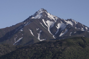
残雪が美しい利尻山
DateTime: [May 27 2018 17:45:11 (Asia/Tokyo)]
Exposures: [F Number: 14.0, Exposure Time: 1/250s, ISO: 100, Exposure Bias: -2.30Ev]
Equipments: [Focal Length: 100.0mm, Maker: PENTAX , Model: PENTAX K-5 II s ]
Location: [Lat: 45° 15' 7.01" N ( 45.251947° ) , Lon: 141° 12' 51.55" E (141.214318° ) , Altitude: 63.3m, Direction: 147° T ]
#27
![Check the location where this photo was taken on the web map.[ Lat.: 45.251913, Lon. : 141.214258, Alt. : 63m ]](https://y2works.net/trip/wp-content/plugins/mylightbox2/icons/map_globe_icon_gry_32.png)
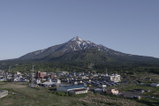
ポン山と利尻山
DateTime: [May 27 2018 17:48:05 (Asia/Tokyo)]
Exposures: [F Number: 9.0, Exposure Time: 1/250s, ISO: 100, Exposure Bias: -1.00Ev]
Equipments: [Focal Length: 21.0mm, Maker: PENTAX , Model: PENTAX K-5 II s ]
Location: [Lat: 45° 15' 6.89" N ( 45.251913° ) , Lon: 141° 12' 51.33" E (141.214258° ) , Altitude: 62.7m, Direction: 147° T ]
#28
![Check the location where this photo was taken on the web map.[ Lat.: 45.240677, Lon. : 141.217372, Alt. : 30m ]](https://y2works.net/trip/wp-content/plugins/mylightbox2/icons/map_globe_icon_gry_32.png)
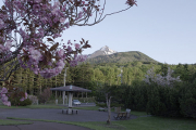
温泉下の公園からも利尻山を望むことができる
DateTime: [May 27 2018 18:29:02 (Asia/Tokyo)]
Exposures: [F Number: 5.6, Exposure Time: 1/640s, ISO: 400, Exposure Bias: -1.00Ev]
Equipments: [Focal Length: 21.0mm, Maker: PENTAX , Model: PENTAX K-5 II s ]
Location: [Lat: 45° 14' 26.44" N ( 45.240677° ) , Lon: 141° 13' 2.54" E (141.217372° ) , Altitude: 30.0m, Direction: 144° T ]
利尻の夜明けは早く、この日は午前3時54分頃に日の出を迎える。既に午前3時くらいからキャンプ場の周りではコマドリ君達がさえずり始めている.キャンプ場から旧登山道を経て甘露泉水の上で登山コースを左にそれ、ポン山.姫沼ハイキングコースへ向かう.
利尻山を目指す人達は大抵は自分の車か宿が用意した車で北麓野営場へ直行するので、旧登山道から登る人は皆無と言って良い.そのせいか旧登山道は倒木が放置され放しで殆ど整備されていない.幸か不幸か殆ど歩く人が居ないので静かな野鳥探索をするには格好のハイキングコースだ.
姫沼コースも殆ど歩く人が居ないのか、沼まで誰とも出会わなかった.姫沼の周辺ではコルリを見かけた.コルリとコマドリは泣き方が似ているが、さえずりの前にチッチッチッという前奏があるので容易に区別が付く.
姫沼に着くとこれまでとは一変してツアーの観光客で騒々しかった.姫沼のすぐ近くまでバスで乗り入れることができるようで、利尻島の観光名所となっているようだ.
【追記】ポン山と姫沼の分岐ポイントの手前あたりで、右手前方の数十メートル先の熊笹に覆われた斜面を、何かが笹藪をかき分けながら歩いて居る大きな音がした.熊笹の背丈は2〜3mはあるので、その姿は確認できなかったが、ガサガサと笹藪をかき分けながら、段々とこちらに近づいて来てるようだった.
最初は地元の人が山菜採りでもしているのかもと思ったが、人の動きにしては奇妙な感じだったので、鹿でも居るだろうと思ったが、鹿であれば人の気配を感じた段階でじっとして立ち止まり慌てて逃げ出す筈だ.ひょっとして熊さん? でも利尻島には鹿や熊、蛇も居ないと聞いていたので、その時は正体を確かめずに先に進んでしまった.
後日、利尻島に居るはずのないヒグマが本道から海を渡って島内に潜伏していたということをニュースで知った.この時私が接近遭遇したのはやっぱり熊さんだったのだろうか...(危なかった!!!)
3日目(5/28) 旧登山道で鳥見散歩
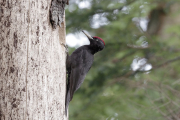
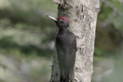
朝一番のフェリーで稚内へ戻る前に、甘露泉水までの旧登山道を往復することにした.この日は風が強く、森の中も風が強く鳥君達もあまり活動的ではないようだ.利尻はクマゲラが多いと聞いていたので、沢山のクマゲラ君達と出会えると期待していたのだが、結局この日に1羽の雄のクマゲラを見かけただけだった.
#01
![Check the location where this photo was taken on the web map.[ Lat.: 45.227090, Lon. : 141.214043, Alt. : 116m ]](https://y2works.net/trip/wp-content/plugins/mylightbox2/icons/map_globe_icon_gry_32.png)
よやくクマゲラ君に出会えた
DateTime: [May 28 2018 04:38:05 (Asia/Tokyo)]
Exposures: [F Number: 0.0, Exposure Time: 1/100s, ISO: 1,600, Exposure Bias: -1.00Ev]
Equipments: [Focal Length: 500.0mm, Maker: PENTAX , Model: PENTAX K-5 II s ]
Location: [Lat: 45° 13' 37.52" N ( 45.227090° ) , Lon: 141° 12' 50.56" E (141.214043° ) , Altitude: 115.6m, Direction: 267° T ]
#02
![Check the location where this photo was taken on the web map.[ Lat.: 45.226942, Lon. : 141.213907, Alt. : 113m ]](https://y2works.net/trip/wp-content/plugins/mylightbox2/icons/map_globe_icon_gry_32.png)
赤いベレー帽のクマゲラ君
DateTime: [May 28 2018 04:39:23 (Asia/Tokyo)]
Exposures: [F Number: 0.0, Exposure Time: 1/80s, ISO: 1,600, Exposure Bias: -1.00Ev]
Equipments: [Focal Length: 500.0mm, Maker: PENTAX , Model: PENTAX K-5 II s ]
Location: [Lat: 45° 13' 36.99" N ( 45.226942° ) , Lon: 141° 12' 50.06" E (141.213907° ) , Altitude: 113.2m, Direction: 293° T ]
#03
![Check the location where this photo was taken on the web map.[ Lat.: 45.225773, Lon. : 141.214408, Alt. : 150m ]](https://y2works.net/trip/wp-content/plugins/mylightbox2/icons/map_globe_icon_gry_32.png)
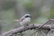
見慣れない鳥が現れた
DateTime: [May 28 2018 04:47:31 (Asia/Tokyo)]
Exposures: [F Number: 0.0, Exposure Time: 1/125s, ISO: 1,600, Exposure Bias: -1.00Ev]
Equipments: [Focal Length: 500.0mm, Maker: PENTAX , Model: PENTAX K-5 II s ]
Location: [Lat: 45° 13' 32.78" N ( 45.225773° ) , Lon: 141° 12' 51.87" E (141.214408° ) , Altitude: 149.7m, Direction: 69° T ]
#04
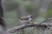
![Check the location where this photo was taken on the web map.[ Lat.: 45.225775, Lon. : 141.214402, Alt. : 150m ]](https://y2works.net/trip/wp-content/plugins/mylightbox2/icons/map_globe_icon_gry_32.png)
顔つきはモズ君だけど頭頂部は灰色
DateTime: [May 28 2018 04:47:33 (Asia/Tokyo)]
Exposures: [F Number: 0.0, Exposure Time: 1/125s, ISO: 1,600, Exposure Bias: -1.00Ev]
Equipments: [Focal Length: 500.0mm, Maker: PENTAX , Model: PENTAX K-5 II s ]
Location: [Lat: 45° 13' 32.79" N ( 45.225775° ) , Lon: 141° 12' 51.85" E (141.214402° ) , Altitude: 149.8m, Direction: 69° T ]
#05
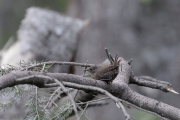
![Check the location where this photo was taken on the web map.[ Lat.: 45.225775, Lon. : 141.214425, Alt. : 153m ]](https://y2works.net/trip/wp-content/plugins/mylightbox2/icons/map_globe_icon_gry_32.png)
ミソッチも盛んにさえずっている
DateTime: [May 28 2018 04:48:28 (Asia/Tokyo)]
Exposures: [F Number: 0.0, Exposure Time: 1/125s, ISO: 1,600, Exposure Bias: -1.00Ev]
Equipments: [Focal Length: 500.0mm, Maker: PENTAX , Model: PENTAX K-5 II s ]
Location: [Lat: 45° 13' 32.79" N ( 45.225775° ) , Lon: 141° 12' 51.93" E (141.214425° ) , Altitude: 152.6m, Direction: 74° T ]
#06
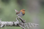
![Check the location where this photo was taken on the web map.[ Lat.: 45.224670, Lon. : 141.214397, Alt. : 191m ]](https://y2works.net/trip/wp-content/plugins/mylightbox2/icons/map_globe_icon_gry_32.png)
この日もコマドリ君が目の前でさえずってくれた
DateTime: [May 28 2018 05:11:05 (Asia/Tokyo)]
Exposures: [F Number: 0.0, Exposure Time: 1/80s, ISO: 800, Exposure Bias: -1.00Ev]
Equipments: [Focal Length: 500.0mm, Maker: PENTAX , Model: PENTAX K-5 II s ]
Location: [Lat: 45° 13' 28.81" N ( 45.224670° ) , Lon: 141° 12' 51.83" E (141.214397° ) , Altitude: 191.2m, Direction: 243° T ]
#07
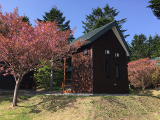
![Check the location where this photo was taken on the web map.[ Lat.: 45.255283, Lon. : 141.188050, Alt. : 23m ]](https://y2works.net/trip/wp-content/plugins/mylightbox2/icons/map_globe_icon_gry_32.png)
キャンプ場ゆーにのバンガロー
DateTime: [May 28 2018 08:00:35 (Asia/Tokyo)]
Exposures: [F Number: 2.2, Exposure Time: 1/663s, ISO: 25, Exposure Bias: 0.00Ev]
Equipments: [Focal Length: 4.2mm, Maker: Apple, Model: iPhone SE]
Location: [Lat: 45° 15' 19.02" N ( 45.255283° ) , Lon: 141° 11' 16.98" E (141.188050° ) , Altitude: 23.5m, Direction: 219° T ]
#08
![Check the location where this photo was taken on the web map.[ Lat.: 45.245583, Lon. : 141.243303, Alt. : 1m ]](https://y2works.net/trip/wp-content/plugins/mylightbox2/icons/map_globe_icon_gry_32.png)
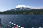
利尻を後に稚内へ
DateTime: [May 28 2018 08:56:35 (Asia/Tokyo)]
Exposures: [F Number: 2.2, Exposure Time: 1/2079s, ISO: 25, Exposure Bias: 0.00Ev]
Equipments: [Focal Length: 4.2mm, Maker: Apple, Model: iPhone SE]
Location: [Lat: 45° 14' 44.10" N ( 45.245583° ) , Lon: 141° 14' 35.89" E (141.243303° ) , Altitude: 1.0m, Direction: 195° T ]
#09
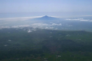
空から見ると 利尻山 = 利尻島 ということが良く解る
DateTime: [May 28 2018 13:56:02 (Asia/Tokyo)]
Exposures: [F Number: 8.0, Exposure Time: 1/1250s, ISO: 80, Exposure Bias: -1.00Ev]
Equipments: [Focal Length: 6.0mm, Maker: RICOH , Model: GR DIGITAL 4 ]


