今年の大雪山の紅葉はイマイチでした
#01
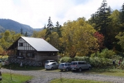
![Check the location where this photo was taken on the web map.[ Lat.: 43.626276, Lon. : 142.930872, Alt. : 1246m ]](https://y2works.net/trip/wp-content/plugins/mylightbox2/icons/map_globe_icon_gry_32.png)
台風の後遺症で今年の高原沼巡りは空沼までのピストンしかできない模様
DateTime: [Sep 25 2016 12:44:18 (Asia/Tokyo)]
Exposures: [F Number: 5.0, Exposure Time: 1/400s, ISO: 80, Exposure Bias: -0.70Ev]
Equipments: [Focal Length: 6.0mm, Maker: RICOH , Model: GR DIGITAL 4 ]
Location: [Lat: 43° 37' 34.59" N ( 43.626276° ) , Lon: 142° 55' 51.14" E (142.930872° ) , Altitude: 1245.5m ]
#02
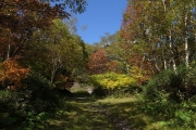
![Check the location where this photo was taken on the web map.[ Lat.: 43.626709, Lon. : 142.930724, Alt. : 1250m ]](https://y2works.net/trip/wp-content/plugins/mylightbox2/icons/map_globe_icon_gry_32.png)
緑岳登山道へ向かう
DateTime: [Sep 25 2016 12:49:52 (Asia/Tokyo)]
Exposures: [F Number: 5.0, Exposure Time: 1/400s, ISO: 80, Exposure Bias: -0.70Ev]
Equipments: [Focal Length: 6.0mm, Maker: RICOH , Model: GR DIGITAL 4 ]
Location: [Lat: 43° 37' 36.15" N ( 43.626709° ) , Lon: 142° 55' 50.61" E (142.930724° ) , Altitude: 1250.3m ]
#03
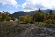
![Check the location where this photo was taken on the web map.[ Lat.: 43.627712, Lon. : 142.930699, Alt. : 1259m ]](https://y2works.net/trip/wp-content/plugins/mylightbox2/icons/map_globe_icon_gry_32.png)
高原温泉の周辺では噴気孔から水蒸気がモクモクと湧き上がっている
DateTime: [Sep 25 2016 12:51:52 (Asia/Tokyo)]
Exposures: [F Number: 6.3, Exposure Time: 1/400s, ISO: 80, Exposure Bias: -0.70Ev]
Equipments: [Focal Length: 6.0mm, Maker: RICOH , Model: GR DIGITAL 4 ]
Location: [Lat: 43° 37' 39.76" N ( 43.627712° ) , Lon: 142° 55' 50.52" E (142.930699° ) , Altitude: 1259.5m ]
#04
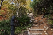
![Check the location where this photo was taken on the web map.[ Lat.: 43.631488, Lon. : 142.930958, Alt. : 1427m ]](https://y2works.net/trip/wp-content/plugins/mylightbox2/icons/map_globe_icon_gry_32.png)
暫くは階段が続く
DateTime: [Sep 25 2016 13:16:30 (Asia/Tokyo)]
Exposures: [F Number: 4.0, Exposure Time: 1/400s, ISO: 80, Exposure Bias: -0.70Ev]
Equipments: [Focal Length: 6.0mm, Maker: RICOH , Model: GR DIGITAL 4 ]
Location: [Lat: 43° 37' 53.36" N ( 43.631488° ) , Lon: 142° 55' 51.45" E (142.930958° ) , Altitude: 1426.7m ]
#05
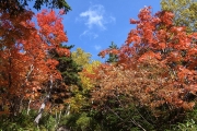
![Check the location where this photo was taken on the web map.[ Lat.: 43.632547, Lon. : 142.932233, Alt. : 1480m ]](https://y2works.net/trip/wp-content/plugins/mylightbox2/icons/map_globe_icon_gry_32.png)
所々ではそれなりに色づいている
DateTime: [Sep 25 2016 13:25:42 (Asia/Tokyo)]
Exposures: [F Number: 3.5, Exposure Time: 1/400s, ISO: 80, Exposure Bias: -2.00Ev]
Equipments: [Focal Length: 6.0mm, Maker: RICOH , Model: GR DIGITAL 4 ]
Location: [Lat: 43° 37' 57.17" N ( 43.632547° ) , Lon: 142° 55' 56.04" E (142.932233° ) , Altitude: 1479.6m ]
#06
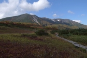
![Check the location where this photo was taken on the web map.[ Lat.: 43.635010, Lon. : 142.931576, Alt. : 1534m ]](https://y2works.net/trip/wp-content/plugins/mylightbox2/icons/map_globe_icon_gry_32.png)
第一花畑より緑岳を望む
DateTime: [Sep 25 2016 13:35:09 (Asia/Tokyo)]
Exposures: [F Number: 6.3, Exposure Time: 1/400s, ISO: 80, Exposure Bias: -1.30Ev]
Equipments: [Focal Length: 6.0mm, Maker: RICOH , Model: GR DIGITAL 4 ]
Location: [Lat: 43° 38' 6.04" N ( 43.635010° ) , Lon: 142° 55' 53.67" E (142.931576° ) , Altitude: 1534.4m ]
#07
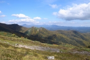
![Check the location where this photo was taken on the web map.[ Lat.: 43.640817, Lon. : 142.928828, Alt. : 1587m ]](https://y2works.net/trip/wp-content/plugins/mylightbox2/icons/map_globe_icon_gry_32.png)
遠くに石狩岳などの東大雪の山々を望む
DateTime: [Sep 25 2016 13:53:40 (Asia/Tokyo)]
Exposures: [F Number: 5.0, Exposure Time: 1/400s, ISO: 80, Exposure Bias: 0.00Ev]
Equipments: [Focal Length: 6.0mm, Maker: RICOH , Model: GR DIGITAL 4 ]
Location: [Lat: 43° 38' 26.94" N ( 43.640817° ) , Lon: 142° 55' 43.78" E (142.928828° ) , Altitude: 1587.3m ]
#08
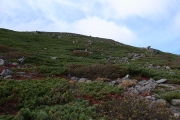
![Check the location where this photo was taken on the web map.[ Lat.: 43.645938, Lon. : 142.921213, Alt. : 1769m ]](https://y2works.net/trip/wp-content/plugins/mylightbox2/icons/map_globe_icon_gry_32.png)
緑岳の岩場の斜面を登って行く
DateTime: [Sep 25 2016 14:27:35 (Asia/Tokyo)]
Exposures: [F Number: 5.0, Exposure Time: 1/400s, ISO: 130, Exposure Bias: 0.00Ev]
Equipments: [Focal Length: 6.0mm, Maker: RICOH , Model: GR DIGITAL 4 ]
Location: [Lat: 43° 38' 45.38" N ( 43.645938° ) , Lon: 142° 55' 16.37" E (142.921213° ) , Altitude: 1769.0m ]
#09
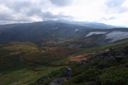
![Check the location where this photo was taken on the web map.[ Lat.: 43.647416, Lon. : 142.921363, Alt. : 1866m ]](https://y2works.net/trip/wp-content/plugins/mylightbox2/icons/map_globe_icon_gry_32.png)
高根ヶ原と高原沼を一望する
DateTime: [Sep 25 2016 14:44:50 (Asia/Tokyo)]
Exposures: [F Number: 9.0, Exposure Time: 1/160s, ISO: 80, Exposure Bias: -0.70Ev]
Equipments: [Focal Length: 6.0mm, Maker: RICOH , Model: GR DIGITAL 4 ]
Location: [Lat: 43° 38' 50.70" N ( 43.647416° ) , Lon: 142° 55' 16.91" E (142.921363° ) , Altitude: 1865.6m ]
#10
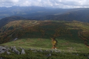
![Check the location where this photo was taken on the web map.[ Lat.: 43.647416, Lon. : 142.921363, Alt. : 1866m ]](https://y2works.net/trip/wp-content/plugins/mylightbox2/icons/map_globe_icon_gry_32.png)
眼下には第一、第二花畑が見えている
DateTime: [Sep 25 2016 14:44:56 (Asia/Tokyo)]
Exposures: [F Number: 9.0, Exposure Time: 1/160s, ISO: 80, Exposure Bias: -0.70Ev]
Equipments: [Focal Length: 6.0mm, Maker: RICOH , Model: GR DIGITAL 4 ]
Location: [Lat: 43° 38' 50.70" N ( 43.647416° ) , Lon: 142° 55' 16.91" E (142.921363° ) , Altitude: 1865.6m ]
#11
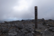
![Check the location where this photo was taken on the web map.[ Lat.: 43.649859, Lon. : 142.920291, Alt. : 2021m ]](https://y2works.net/trip/wp-content/plugins/mylightbox2/icons/map_globe_icon_gry_32.png)
緑岳の頂上に着く頃には辺りはガスで覆われてしまっていた
DateTime: [Sep 25 2016 15:10:32 (Asia/Tokyo)]
Exposures: [F Number: 9.0, Exposure Time: 1/160s, ISO: 80, Exposure Bias: -0.70Ev]
Equipments: [Focal Length: 6.0mm, Maker: RICOH , Model: GR DIGITAL 4 ]
Location: [Lat: 43° 38' 59.49" N ( 43.649859° ) , Lon: 142° 55' 13.05" E (142.920291° ) , Altitude: 2020.8m ]
#12
![Check the location where this photo was taken on the web map.[ Lat.: 43.649911, Lon. : 142.920149, Alt. : 2023m ]](https://y2works.net/trip/wp-content/plugins/mylightbox2/icons/map_globe_icon_gry_32.png)
頂上で長居せずに白雲岳避難小屋へ向かう
DateTime: [Sep 25 2016 15:14:41 (Asia/Tokyo)]
Exposures: [F Number: 7.1, Exposure Time: 1/160s, ISO: 80, Exposure Bias: -0.70Ev]
Equipments: [Focal Length: 6.0mm, Maker: RICOH , Model: GR DIGITAL 4 ]
Location: [Lat: 43° 38' 59.68" N ( 43.649911° ) , Lon: 142° 55' 12.54" E (142.920149° ) , Altitude: 2022.8m ]
#13
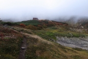
![Check the location where this photo was taken on the web map.[ Lat.: 43.656548, Lon. : 142.915608, Alt. : 1964m ]](https://y2works.net/trip/wp-content/plugins/mylightbox2/icons/map_globe_icon_gry_32.png)
ガスの切れ間から白雲岳の避難小屋が見えてきた
DateTime: [Sep 25 2016 15:41:45 (Asia/Tokyo)]
Exposures: [F Number: 4.0, Exposure Time: 1/160s, ISO: 80, Exposure Bias: -0.70Ev]
Equipments: [Focal Length: 6.0mm, Maker: RICOH , Model: GR DIGITAL 4 ]
Location: [Lat: 43° 39' 23.57" N ( 43.656548° ) , Lon: 142° 54' 56.19" E (142.915608° ) , Altitude: 1963.6m ]
#14
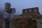
![Check the location where this photo was taken on the web map.[ Lat.: 43.657365, Lon. : 142.914455, Alt. : 1994m ]](https://y2works.net/trip/wp-content/plugins/mylightbox2/icons/map_globe_icon_gry_32.png)
天気がイマイチなので今夜は小屋の中に泊まることにした
DateTime: [Sep 25 2016 15:46:42 (Asia/Tokyo)]
Exposures: [F Number: 5.0, Exposure Time: 1/160s, ISO: 80, Exposure Bias: -0.70Ev]
Equipments: [Focal Length: 6.0mm, Maker: RICOH , Model: GR DIGITAL 4 ]
Location: [Lat: 43° 39' 26.51" N ( 43.657365° ) , Lon: 142° 54' 52.04" E (142.914455° ) , Altitude: 1993.9m ]
毎年9月下旬の紅葉シーズンに大雪山系の山々を訪れているが、今年は一泊二日の短期間での滞在だったので公共交通機関が使える高原温泉から旭岳温泉までのショートトレイルとした.今年の北海道は相次ぐ台風の直撃を受け、大雪周辺の道路網や鉄道は壊滅的な被害を受けて未だに不通が続いていた.
今年の高原沼へのシャトルバスの運行は台風被害の影響もあり、9/22〜25までの短期間運行となっており最終日のシャトルバス便で高原温泉へ向かった.高原温泉へ向かう林道も台風の被害を受けており、紅葉シーズンに向けて大急ぎで仮復旧させたようだった.林道沿いの石狩川やヤンベタップ側の河原は夥しい数の流木で覆われていて今年の台風被害の深刻さを物語っていた.
例年であれば山の上は初冠雪を迎えている頃なのだが、今年は9月の異常高温で大雪周辺の山々の紅葉も今一つ冴えないようだった.
今回は高原温泉から緑岳経由で白雲岳避難小屋で一泊し、北鎮岳から比布岳、当麻岳、裾合平を経て姿見まで行く予定だ.下界の天気予報では好天が続くことになっていたが、山の上の方は夕方からガスってきて風も強くなってきたのでテントを張らずに、避難小屋の中に泊まることにした.
夜から翌朝方にかけて暴風と濃いガスで視界が効かない状態だった.一晩中強風で小屋が地震のように揺れていてなかなか眠りに付けなかった.白雲岳避難小屋は今シーズンの最終日ということで、26日の午前中で管理人さんも山を降りるということだった.
#01
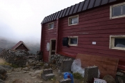
![Check the location where this photo was taken on the web map.[ Lat.: 43.657608, Lon. : 142.914585, Alt. : 1992m ]](https://y2works.net/trip/wp-content/plugins/mylightbox2/icons/map_globe_icon_gry_32.png)
今シーズンの小屋終い準備で忙しそう
DateTime: [Sep 26 2016 07:55:03 (Asia/Tokyo)]
Exposures: [F Number: 6.3, Exposure Time: 1/160s, ISO: 80, Exposure Bias: -0.70Ev]
Equipments: [Focal Length: 6.0mm, Maker: RICOH , Model: GR DIGITAL 4 ]
Location: [Lat: 43° 39' 27.39" N ( 43.657608° ) , Lon: 142° 54' 52.51" E (142.914585° ) , Altitude: 1992.5m ]
#02
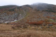
![Check the location where this photo was taken on the web map.[ Lat.: 43.658086, Lon. : 142.914180, Alt. : 1979m ]](https://y2works.net/trip/wp-content/plugins/mylightbox2/icons/map_globe_icon_gry_32.png)
まだ雪渓が残っていたので水の確保は問題なかった
DateTime: [Sep 26 2016 07:56:46 (Asia/Tokyo)]
Exposures: [F Number: 4.5, Exposure Time: 1/160s, ISO: 80, Exposure Bias: -0.70Ev]
Equipments: [Focal Length: 6.0mm, Maker: RICOH , Model: GR DIGITAL 4 ]
Location: [Lat: 43° 39' 29.11" N ( 43.658086° ) , Lon: 142° 54' 51.05" E (142.914180° ) , Altitude: 1979.5m ]
#03
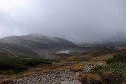
![Check the location where this photo was taken on the web map.[ Lat.: 43.661528, Lon. : 142.917710, Alt. : 2079m ]](https://y2works.net/trip/wp-content/plugins/mylightbox2/icons/map_globe_icon_gry_32.png)
風が大部おさまってきたのでとりあえず小屋を後にして北海岳へ向かう
DateTime: [Sep 26 2016 08:13:18 (Asia/Tokyo)]
Exposures: [F Number: 9.0, Exposure Time: 1/160s, ISO: 80, Exposure Bias: -0.70Ev]
Equipments: [Focal Length: 6.0mm, Maker: RICOH , Model: GR DIGITAL 4 ]
Location: [Lat: 43° 39' 41.50" N ( 43.661528° ) , Lon: 142° 55' 3.75" E (142.917710° ) , Altitude: 2079.5m ]
#04
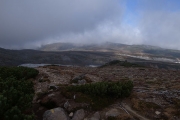
![Check the location where this photo was taken on the web map.[ Lat.: 43.665131, Lon. : 142.916076, Alt. : 2111m ]](https://y2works.net/trip/wp-content/plugins/mylightbox2/icons/map_globe_icon_gry_32.png)
白雲分岐より北海岳方面を望む
DateTime: [Sep 26 2016 08:23:22 (Asia/Tokyo)]
Exposures: [F Number: 4.0, Exposure Time: 1/1070s, ISO: 80, Exposure Bias: -0.70Ev]
Equipments: [Focal Length: 6.0mm, Maker: RICOH , Model: GR DIGITAL 4 ]
Location: [Lat: 43° 39' 54.47" N ( 43.665131° ) , Lon: 142° 54' 57.87" E (142.916076° ) , Altitude: 2111.2m ]
#05
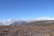
![Check the location where this photo was taken on the web map.[ Lat.: 43.667931, Lon. : 142.908264, Alt. : 2085m ]](https://y2works.net/trip/wp-content/plugins/mylightbox2/icons/map_globe_icon_gry_32.png)
北海岳付近はガスが切れていて晴れ間がのぞいていた
DateTime: [Sep 26 2016 08:42:32 (Asia/Tokyo)]
Exposures: [F Number: 9.0, Exposure Time: 1/160s, ISO: 80, Exposure Bias: -0.70Ev]
Equipments: [Focal Length: 6.0mm, Maker: RICOH , Model: GR DIGITAL 4 ]
Location: [Lat: 43° 40' 4.55" N ( 43.667931° ) , Lon: 142° 54' 29.75" E (142.908264° ) , Altitude: 2084.8m ]
#06
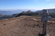
![Check the location where this photo was taken on the web map.[ Lat.: 43.676510, Lon. : 142.896006, Alt. : 2155m ]](https://y2works.net/trip/wp-content/plugins/mylightbox2/icons/map_globe_icon_gry_32.png)
風下側の烏帽子岳方向は視界が効いている
DateTime: [Sep 26 2016 09:10:10 (Asia/Tokyo)]
Exposures: [F Number: 9.0, Exposure Time: 1/160s, ISO: 80, Exposure Bias: -0.70Ev]
Equipments: [Focal Length: 6.0mm, Maker: RICOH , Model: GR DIGITAL 4 ]
Location: [Lat: 43° 40' 35.44" N ( 43.676510° ) , Lon: 142° 53' 45.62" E (142.896006° ) , Altitude: 2154.9m ]
#07
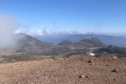
![Check the location where this photo was taken on the web map.[ Lat.: 43.676510, Lon. : 142.896013, Alt. : 2155m ]](https://y2works.net/trip/wp-content/plugins/mylightbox2/icons/map_globe_icon_gry_32.png)
黒岳方面も視界は良好なようだ
DateTime: [Sep 26 2016 09:10:13 (Asia/Tokyo)]
Exposures: [F Number: 9.0, Exposure Time: 1/160s, ISO: 80, Exposure Bias: -0.70Ev]
Equipments: [Focal Length: 6.0mm, Maker: RICOH , Model: GR DIGITAL 4 ]
Location: [Lat: 43° 40' 35.44" N ( 43.676510° ) , Lon: 142° 53' 45.65" E (142.896013° ) , Altitude: 2154.9m ]
#08
![Check the location where this photo was taken on the web map.[ Lat.: 43.676486, Lon. : 142.895935, Alt. : 2156m ]](https://y2works.net/trip/wp-content/plugins/mylightbox2/icons/map_globe_icon_gry_32.png)
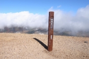
御鉢の向側は相変わらずガスの中
DateTime: [Sep 26 2016 09:10:49 (Asia/Tokyo)]
Exposures: [F Number: 9.0, Exposure Time: 1/160s, ISO: 80, Exposure Bias: -1.00Ev]
Equipments: [Focal Length: 6.0mm, Maker: RICOH , Model: GR DIGITAL 4 ]
Location: [Lat: 43° 40' 35.35" N ( 43.676486° ) , Lon: 142° 53' 45.37" E (142.895935° ) , Altitude: 2155.9m ]
#09
![Check the location where this photo was taken on the web map.[ Lat.: 43.676478, Lon. : 142.895942, Alt. : 2156m ]](https://y2works.net/trip/wp-content/plugins/mylightbox2/icons/map_globe_icon_gry_32.png)
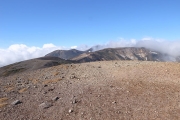
とりあえず間宮岳方向へ足を進めることにした
DateTime: [Sep 26 2016 09:10:54 (Asia/Tokyo)]
Exposures: [F Number: 9.0, Exposure Time: 1/160s, ISO: 80, Exposure Bias: -1.00Ev]
Equipments: [Focal Length: 6.0mm, Maker: RICOH , Model: GR DIGITAL 4 ]
Location: [Lat: 43° 40' 35.32" N ( 43.676478° ) , Lon: 142° 53' 45.39" E (142.895942° ) , Altitude: 2155.9m ]
#10
![Check the location where this photo was taken on the web map.[ Lat.: 43.676519, Lon. : 142.895865, Alt. : 2161m ]](https://y2works.net/trip/wp-content/plugins/mylightbox2/icons/map_globe_icon_gry_32.png)
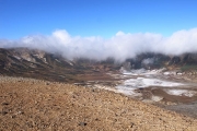
北鎮岳や比布岳は相変わらずガスで見えない
DateTime: [Sep 26 2016 09:11:45 (Asia/Tokyo)]
Exposures: [F Number: 9.0, Exposure Time: 1/160s, ISO: 80, Exposure Bias: -1.00Ev]
Equipments: [Focal Length: 6.0mm, Maker: RICOH , Model: GR DIGITAL 4 ]
Location: [Lat: 43° 40' 35.47" N ( 43.676519° ) , Lon: 142° 53' 45.11" E (142.895865° ) , Altitude: 2161.2m ]
#11
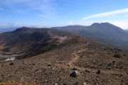
![Check the location where this photo was taken on the web map.[ Lat.: 43.670829, Lon. : 142.874896, Alt. : 2181m ]](https://y2works.net/trip/wp-content/plugins/mylightbox2/icons/map_globe_icon_gry_32.png)
御鉢の南側の山々とその向こうに白雲岳
DateTime: [Sep 26 2016 09:50:19 (Asia/Tokyo)]
Exposures: [F Number: 9.0, Exposure Time: 1/160s, ISO: 80, Exposure Bias: -1.00Ev]
Equipments: [Focal Length: 6.0mm, Maker: RICOH , Model: GR DIGITAL 4 ]
Location: [Lat: 43° 40' 14.98" N ( 43.670829° ) , Lon: 142° 52' 29.62" E (142.874896° ) , Altitude: 2180.9m ]
#12
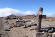
![Check the location where this photo was taken on the web map.[ Lat.: 43.671861, Lon. : 142.872793, Alt. : 2186m ]](https://y2works.net/trip/wp-content/plugins/mylightbox2/icons/map_globe_icon_gry_32.png)
間宮岳分岐から旭岳を望む
DateTime: [Sep 26 2016 09:53:51 (Asia/Tokyo)]
Exposures: [F Number: 9.0, Exposure Time: 1/160s, ISO: 80, Exposure Bias: -1.00Ev]
Equipments: [Focal Length: 6.0mm, Maker: RICOH , Model: GR DIGITAL 4 ]
Location: [Lat: 43° 40' 18.70" N ( 43.671861° ) , Lon: 142° 52' 22.05" E (142.872793° ) , Altitude: 2185.7m ]
#13
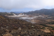
![Check the location where this photo was taken on the web map.[ Lat.: 43.680351, Lon. : 142.872797, Alt. : 2055m ]](https://y2works.net/trip/wp-content/plugins/mylightbox2/icons/map_globe_icon_gry_32.png)
中岳分岐から御鉢の中を望む
DateTime: [Sep 26 2016 10:23:31 (Asia/Tokyo)]
Exposures: [F Number: 9.0, Exposure Time: 1/160s, ISO: 80, Exposure Bias: -1.00Ev]
Equipments: [Focal Length: 6.0mm, Maker: RICOH , Model: GR DIGITAL 4 ]
Location: [Lat: 43° 40' 49.26" N ( 43.680351° ) , Lon: 142° 52' 22.07" E (142.872797° ) , Altitude: 2055.4m ]
#14
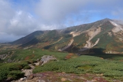
![Check the location where this photo was taken on the web map.[ Lat.: 43.681152, Lon. : 142.866322, Alt. : 1953m ]](https://y2works.net/trip/wp-content/plugins/mylightbox2/icons/map_globe_icon_gry_32.png)
裾合平へ下りて行くと大部視界が良くなった
DateTime: [Sep 26 2016 10:36:46 (Asia/Tokyo)]
Exposures: [F Number: 9.0, Exposure Time: 1/160s, ISO: 80, Exposure Bias: -1.00Ev]
Equipments: [Focal Length: 6.0mm, Maker: RICOH , Model: GR DIGITAL 4 ]
Location: [Lat: 43° 40' 52.15" N ( 43.681152° ) , Lon: 142° 51' 58.76" E (142.866322° ) , Altitude: 1952.6m ]
#15
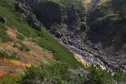
![Check the location where this photo was taken on the web map.[ Lat.: 43.682055, Lon. : 142.861049, Alt. : 1871m ]](https://y2works.net/trip/wp-content/plugins/mylightbox2/icons/map_globe_icon_gry_32.png)
中岳温泉が近づくと辺りは硫黄臭が漂う
DateTime: [Sep 26 2016 10:47:55 (Asia/Tokyo)]
Exposures: [F Number: 7.1, Exposure Time: 1/160s, ISO: 80, Exposure Bias: -1.00Ev]
Equipments: [Focal Length: 6.0mm, Maker: RICOH , Model: GR DIGITAL 4 ]
Location: [Lat: 43° 40' 55.40" N ( 43.682055° ) , Lon: 142° 51' 39.78" E (142.861049° ) , Altitude: 1871.3m ]
#16
![Check the location where this photo was taken on the web map.[ Lat.: 43.681682, Lon. : 142.861188, Alt. : 1833m ]](https://y2works.net/trip/wp-content/plugins/mylightbox2/icons/map_globe_icon_gry_32.png)
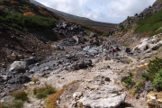
中岳温泉
DateTime: [Sep 26 2016 10:52:32 (Asia/Tokyo)]
Exposures: [F Number: 9.0, Exposure Time: 1/160s, ISO: 80, Exposure Bias: -1.00Ev]
Equipments: [Focal Length: 6.0mm, Maker: RICOH , Model: GR DIGITAL 4 ]
Location: [Lat: 43° 40' 54.05" N ( 43.681682° ) , Lon: 142° 51' 40.28" E (142.861188° ) , Altitude: 1832.9m ]
#17
![Check the location where this photo was taken on the web map.[ Lat.: 43.681486, Lon. : 142.860892, Alt. : 1825m ]](https://y2works.net/trip/wp-content/plugins/mylightbox2/icons/map_globe_icon_gry_32.png)
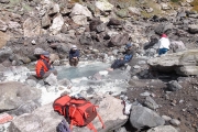
のんびり足湯に浸かってほっこり
DateTime: [Sep 26 2016 10:58:46 (Asia/Tokyo)]
Exposures: [F Number: 9.0, Exposure Time: 1/160s, ISO: 80, Exposure Bias: -1.00Ev]
Equipments: [Focal Length: 6.0mm, Maker: RICOH , Model: GR DIGITAL 4 ]
Location: [Lat: 43° 40' 53.35" N ( 43.681486° ) , Lon: 142° 51' 39.21" E (142.860892° ) , Altitude: 1825.2m ]
#18
![Check the location where this photo was taken on the web map.[ Lat.: 43.680494, Lon. : 142.854420, Alt. : 1764m ]](https://y2works.net/trip/wp-content/plugins/mylightbox2/icons/map_globe_icon_gry_32.png)
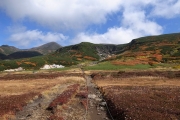
やっと北鎮岳が顔を出してくれた
DateTime: [Sep 26 2016 11:20:16 (Asia/Tokyo)]
Exposures: [F Number: 9.0, Exposure Time: 1/160s, ISO: 80, Exposure Bias: -1.00Ev]
Equipments: [Focal Length: 6.0mm, Maker: RICOH , Model: GR DIGITAL 4 ]
Location: [Lat: 43° 40' 49.78" N ( 43.680494° ) , Lon: 142° 51' 15.91" E (142.854420° ) , Altitude: 1763.7m ]
#19
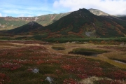
![Check the location where this photo was taken on the web map.[ Lat.: 43.680070, Lon. : 142.852416, Alt. : 1764m ]](https://y2works.net/trip/wp-content/plugins/mylightbox2/icons/map_globe_icon_gry_32.png)
裾合平付近は湿原が広がっている
DateTime: [Sep 26 2016 11:23:05 (Asia/Tokyo)]
Exposures: [F Number: 7.1, Exposure Time: 1/160s, ISO: 80, Exposure Bias: -1.00Ev]
Equipments: [Focal Length: 6.0mm, Maker: RICOH , Model: GR DIGITAL 4 ]
Location: [Lat: 43° 40' 48.25" N ( 43.680070° ) , Lon: 142° 51' 8.70" E (142.852416° ) , Altitude: 1764.2m ]
#20
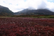
![Check the location where this photo was taken on the web map.[ Lat.: 43.680019, Lon. : 142.850517, Alt. : 1756m ]](https://y2works.net/trip/wp-content/plugins/mylightbox2/icons/map_globe_icon_gry_32.png)
この辺りはチングルマの一大群生地のようだ
DateTime: [Sep 26 2016 11:25:29 (Asia/Tokyo)]
Exposures: [F Number: 9.0, Exposure Time: 1/160s, ISO: 80, Exposure Bias: -1.00Ev]
Equipments: [Focal Length: 6.0mm, Maker: RICOH , Model: GR DIGITAL 4 ]
Location: [Lat: 43° 40' 48.07" N ( 43.680019° ) , Lon: 142° 51' 1.86" E (142.850517° ) , Altitude: 1756.0m ]
#21
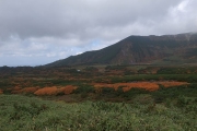
![Check the location where this photo was taken on the web map.[ Lat.: 43.675761, Lon. : 142.844258, Alt. : 1740m ]](https://y2works.net/trip/wp-content/plugins/mylightbox2/icons/map_globe_icon_gry_32.png)
次回は沼ノ平や愛山渓方面へ足を延ばしてみよう
DateTime: [Sep 26 2016 11:49:31 (Asia/Tokyo)]
Exposures: [F Number: 9.0, Exposure Time: 1/160s, ISO: 80, Exposure Bias: -1.00Ev]
Equipments: [Focal Length: 6.0mm, Maker: RICOH , Model: GR DIGITAL 4 ]
Location: [Lat: 43° 40' 32.74" N ( 43.675761° ) , Lon: 142° 50' 39.33" E (142.844258° ) , Altitude: 1740.1m ]
#22
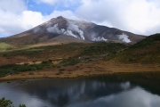
![Check the location where this photo was taken on the web map.[ Lat.: 43.664618, Lon. : 142.828453, Alt. : 1629m ]](https://y2works.net/trip/wp-content/plugins/mylightbox2/icons/map_globe_icon_gry_32.png)
ガスの晴れ間から旭岳が顔を覗かせた
DateTime: [Sep 26 2016 12:25:43 (Asia/Tokyo)]
Exposures: [F Number: 7.1, Exposure Time: 1/160s, ISO: 80, Exposure Bias: -1.00Ev]
Equipments: [Focal Length: 6.0mm, Maker: RICOH , Model: GR DIGITAL 4 ]
Location: [Lat: 43° 39' 52.62" N ( 43.664618° ) , Lon: 142° 49' 42.43" E (142.828453° ) , Altitude: 1629.1m ]
#23
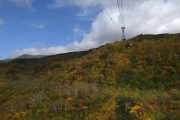
紅葉が大部下まで下りてきたようだ
DateTime: [Sep 26 2016 12:50:18 (Asia/Tokyo)]
Exposures: [F Number: 9.0, Exposure Time: 1/160s, ISO: 80, Exposure Bias: -1.00Ev]
Equipments: [Focal Length: 6.0mm, Maker: RICOH , Model: GR DIGITAL 4 ]
#24
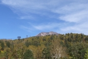
帰る頃にはすっかり好天になっていた...
DateTime: [Sep 26 2016 13:59:09 (Asia/Tokyo)]
Exposures: [F Number: 9.0, Exposure Time: 1/160s, ISO: 80, Exposure Bias: -1.00Ev]
Equipments: [Focal Length: 6.0mm, Maker: RICOH , Model: GR DIGITAL 4 ]
翌朝になっても相変わらず強風とガスが続いていたが、とりあえず北海岳まで行って、そこで旭岳方面か黒岳方面へ向かうことにした.北海岳の周辺はガスが途切れて視界が効いていたが、西風とともに旭岳方面から次々とガスが流れてくるので、旭岳や北鎮岳は完全にガスの中だった.風下の黒岳方面は視界が効いて楽に下山できそうだったが、とりあえず間宮岳まで行ってみることにした.
間宮岳で旭岳からやって来た人の話では、ロープウェイは通常運行されているとの事だったので、とりあえず中岳分岐から中岳温泉、裾合平経由でロープウェイ姿見駅まで下りることにした.中岳温泉まで下りてくるとガスも途切れ風も弱くなってきた.ここから先は一般のハイキングコースとなり、一眼デジを手にしたおじさん達とすれ違う事が多くなる.姿見駅近くになると大勢の一般観光客で賑やかになり、なんとなく居心地が悪い.相変わらず中国人観光客が大挙してやってきており、廻りは中国人だらけだ.
ぼったくりロープウェイを使わずに天女ヶ原経由で下山したかったが、今夜の内に帰京したかったのでロープウェイで下山して、一風呂浴びてから空港へ向かうことにする.一風呂浴びて帰りのバスに乗る頃には、山の上のガスもすっかり晴れて絶好の好天となっていた.午前中から晴れてくれていれば...
